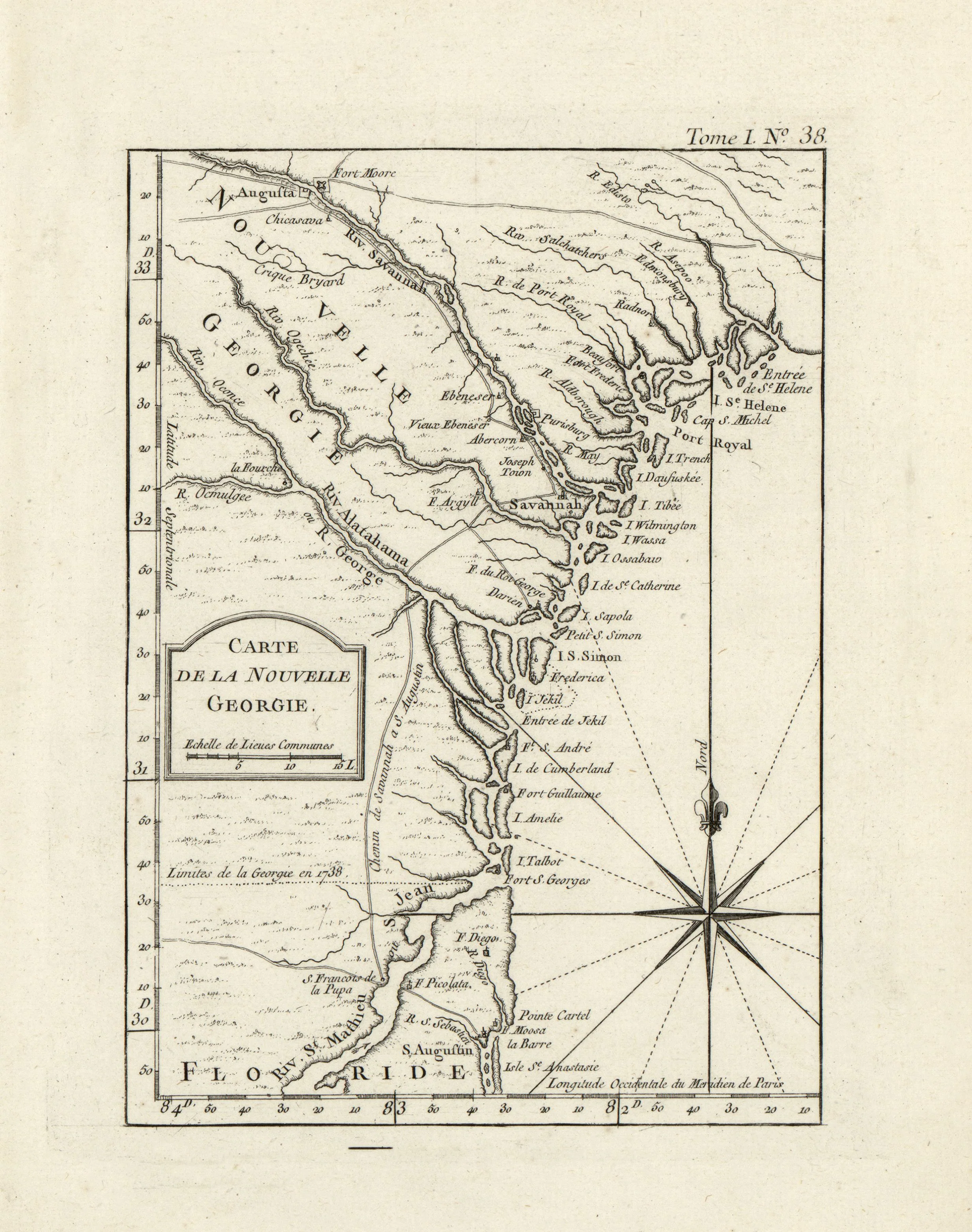
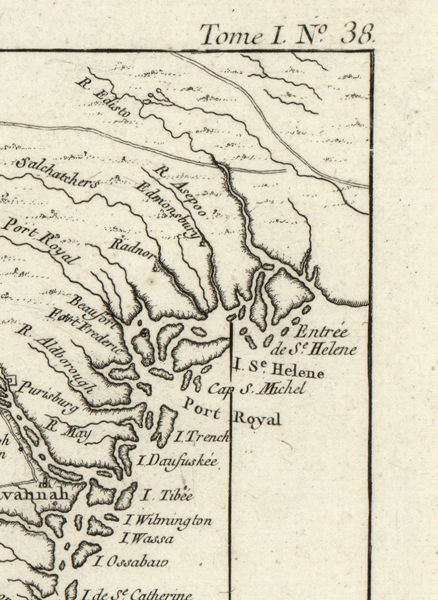
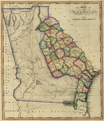
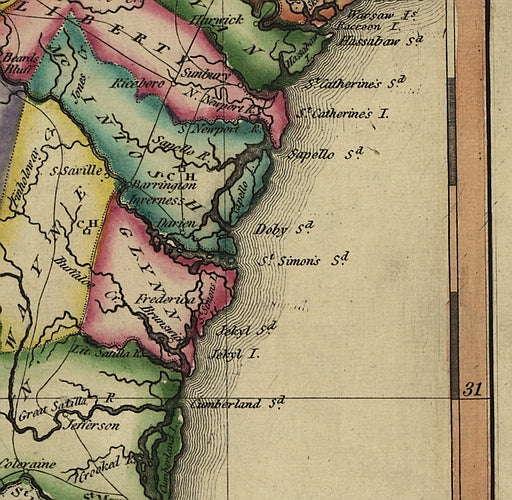
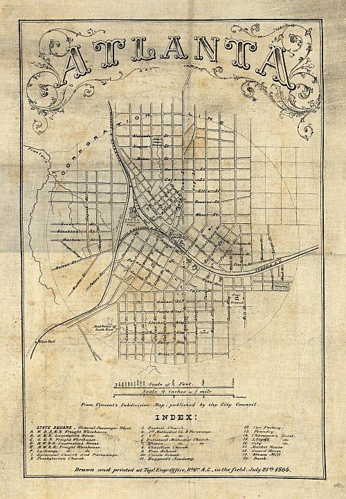
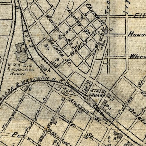
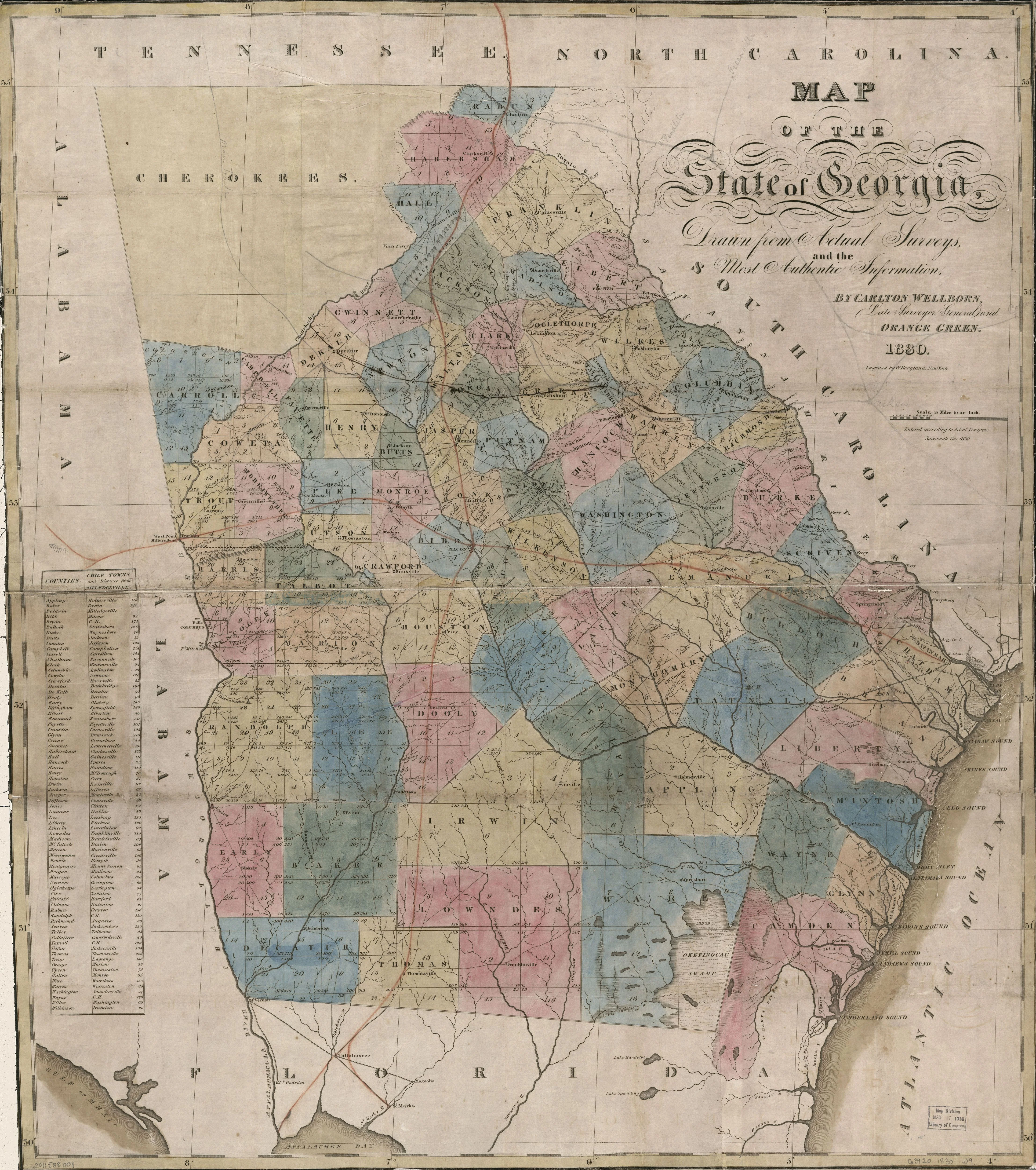
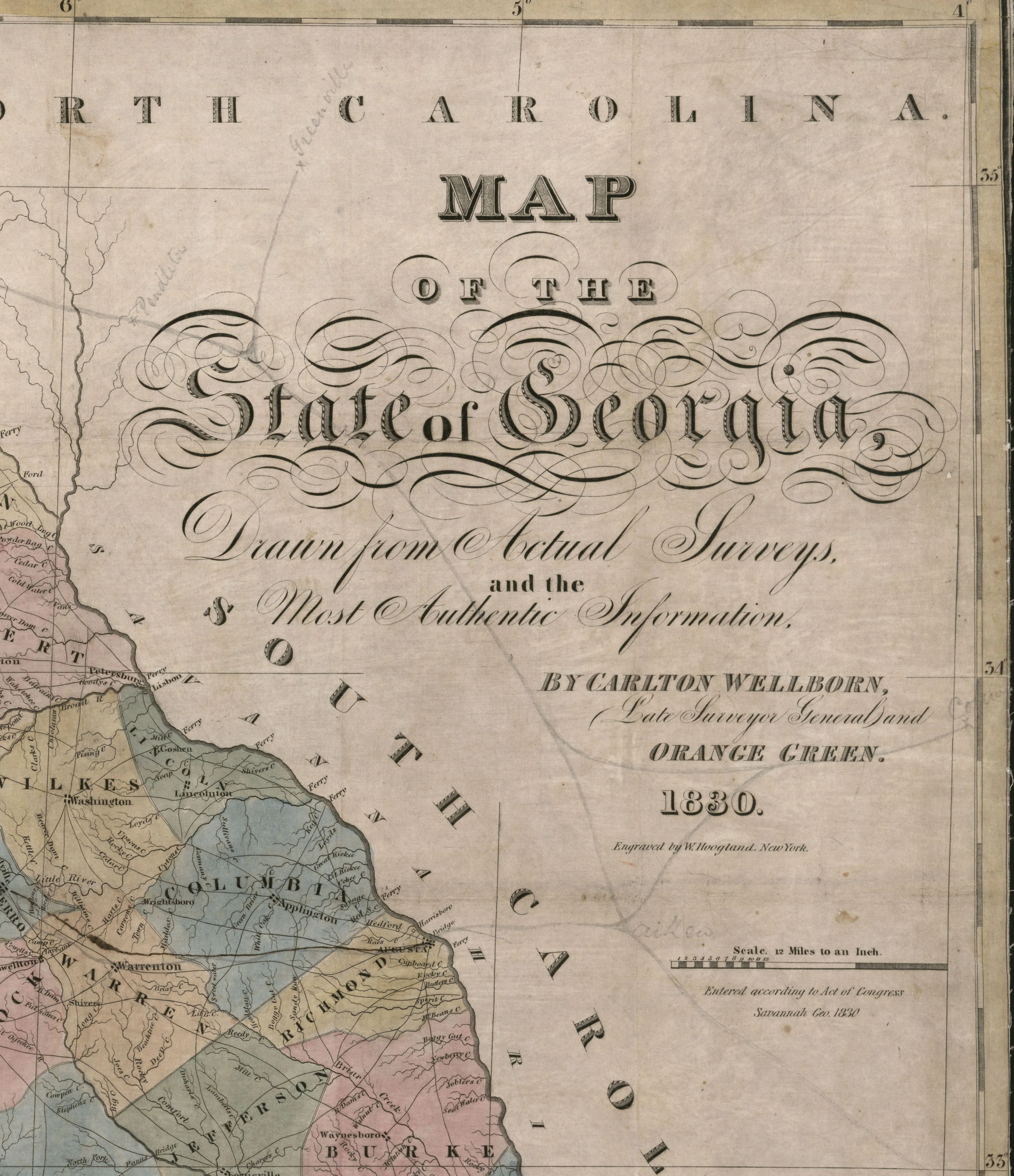
Map of the state of Georgia
Map of the state of Georgia.
Relief shown pictorially.
- Includes a table showing counties with the distance between the counties' "chief towns" and Milledgeville.
- Shows land districts and includes numbers of land lots.
This beautiful reproduction is printed on heavy, acid free stock using HP 100 year ink and is excellent for framing.
This map comes rolled and shipped in a sturdy cardboard tube.
Size: 27 " x 31"
Product Information
Product Information
Shipping & Returns
Shipping & Returns


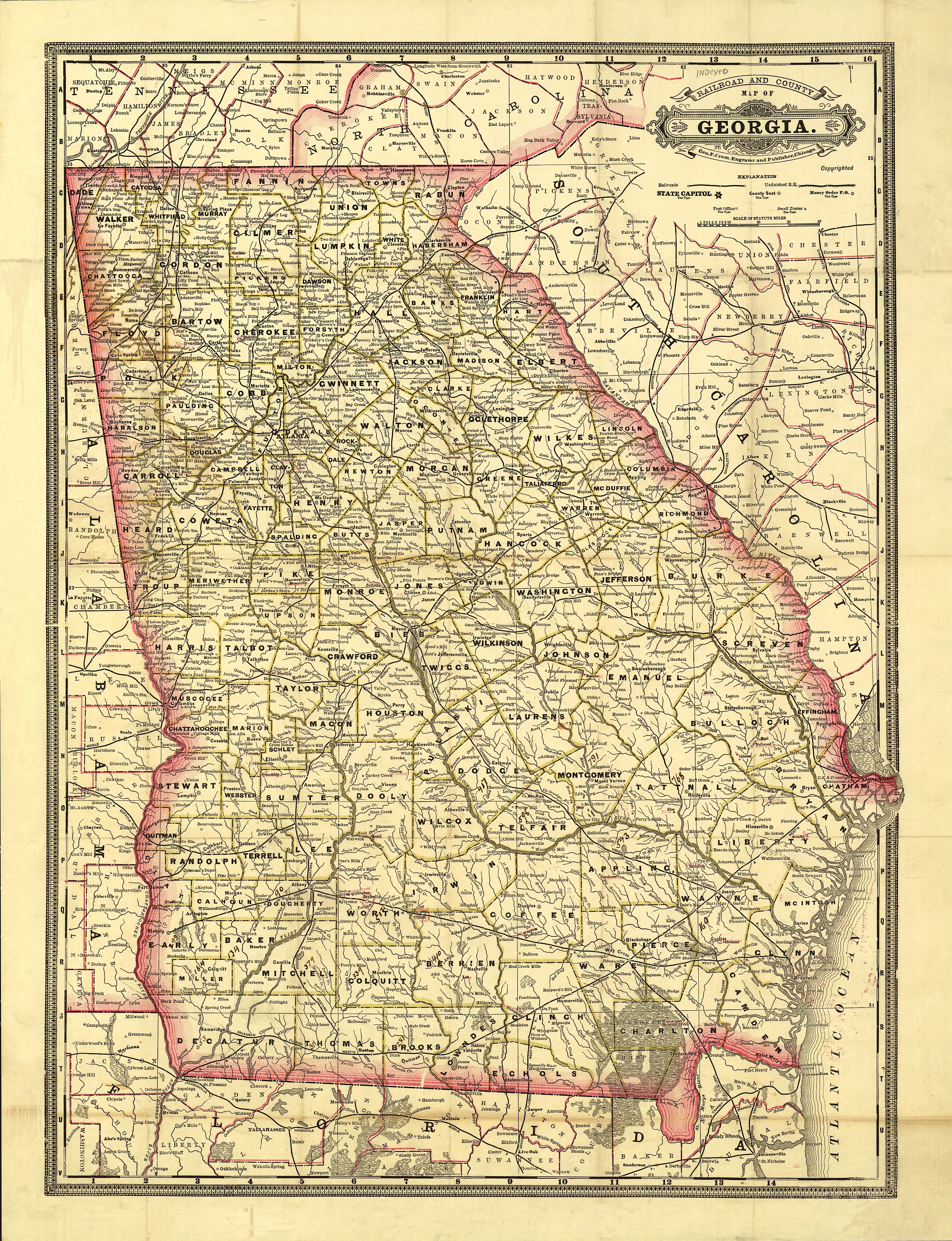
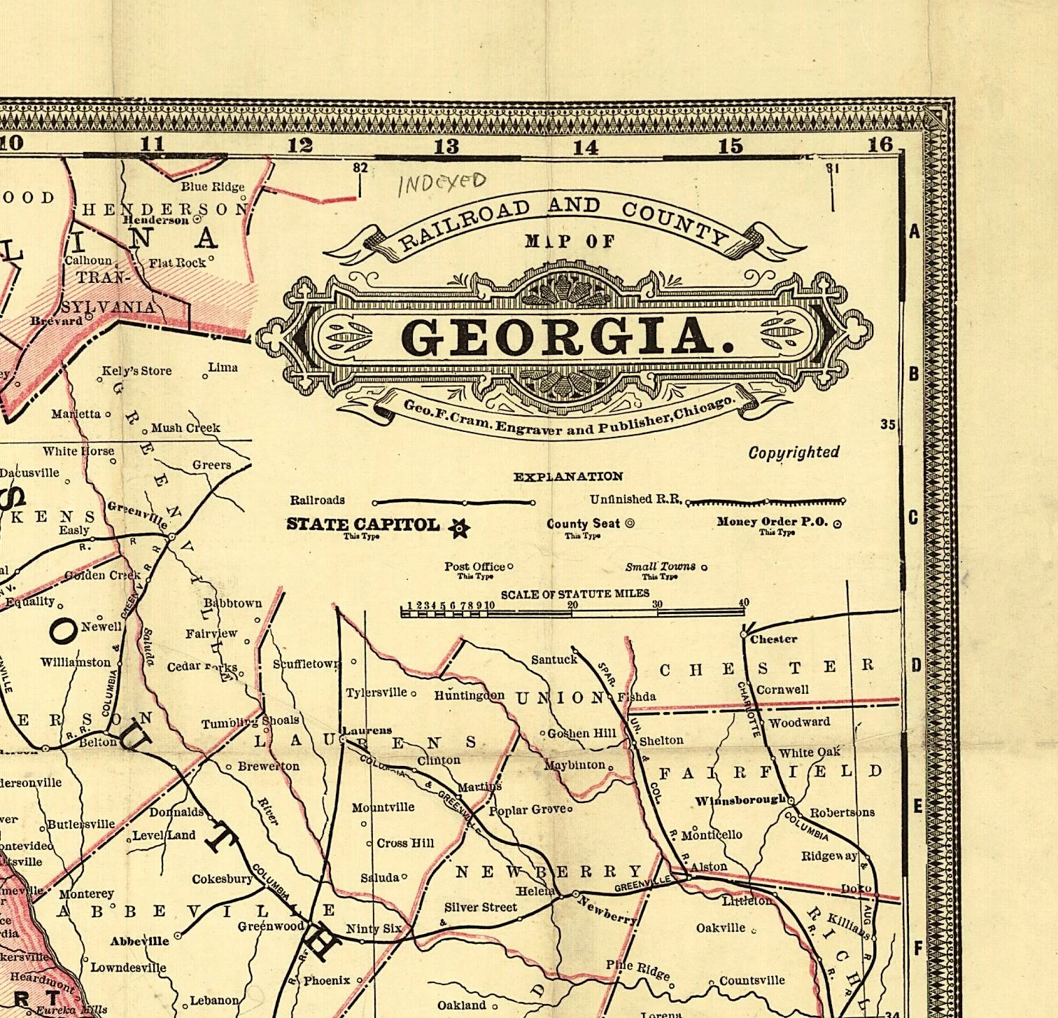
Map of the state of Georgia
Map of the state of Georgia
Map of the state of Georgia.
Relief shown pictorially.
- Includes a table showing counties with the distance between the counties' "chief towns" and Milledgeville.
- Shows land districts and includes numbers of land lots.
This beautiful reproduction is printed on heavy, acid free stock using HP 100 year ink and is excellent for framing.
This map comes rolled and shipped in a sturdy cardboard tube.
Size: 27 " x 31"
Original: $39.95
-65%$39.95
$13.98Product Information
Product Information
Shipping & Returns
Shipping & Returns
Description
Map of the state of Georgia.
Relief shown pictorially.
- Includes a table showing counties with the distance between the counties' "chief towns" and Milledgeville.
- Shows land districts and includes numbers of land lots.
This beautiful reproduction is printed on heavy, acid free stock using HP 100 year ink and is excellent for framing.
This map comes rolled and shipped in a sturdy cardboard tube.
Size: 27 " x 31"