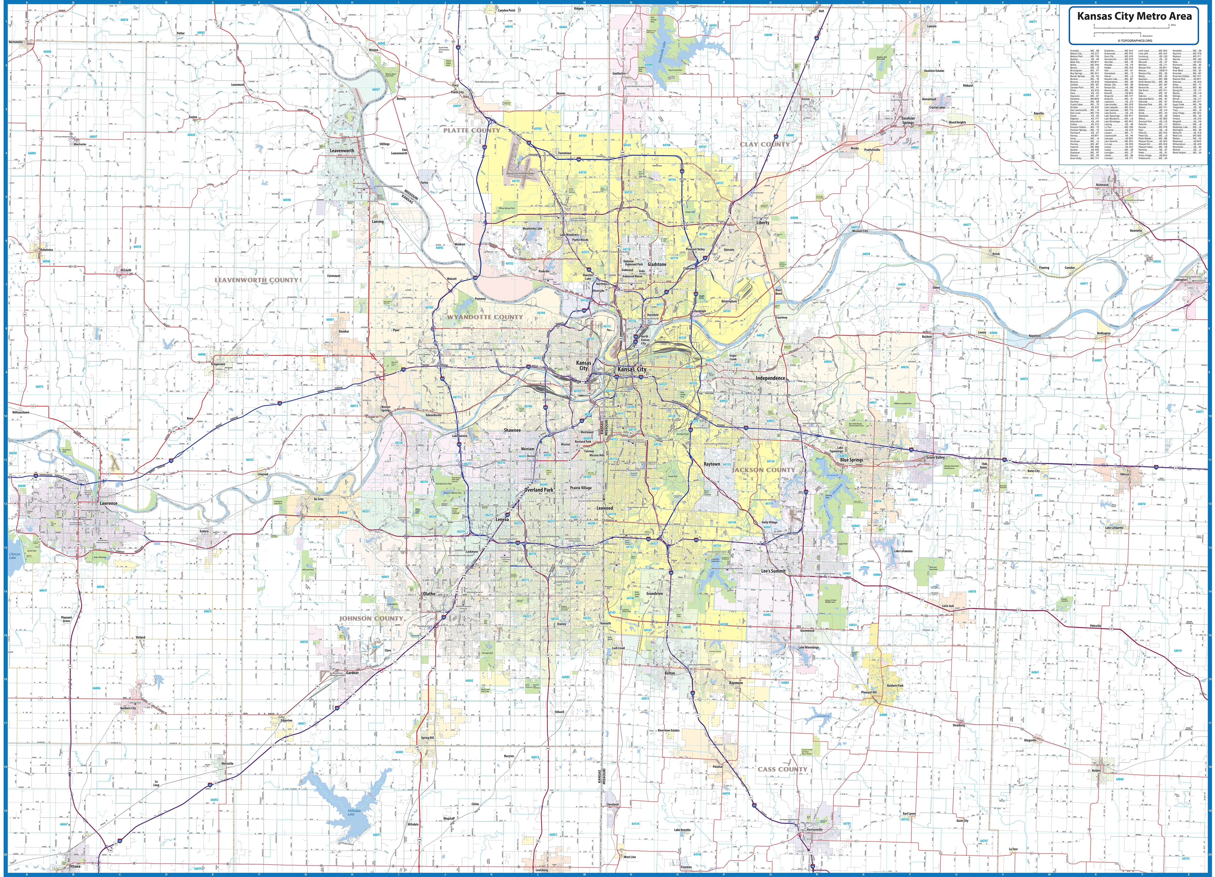
Kansas City Metro Area Wall Map
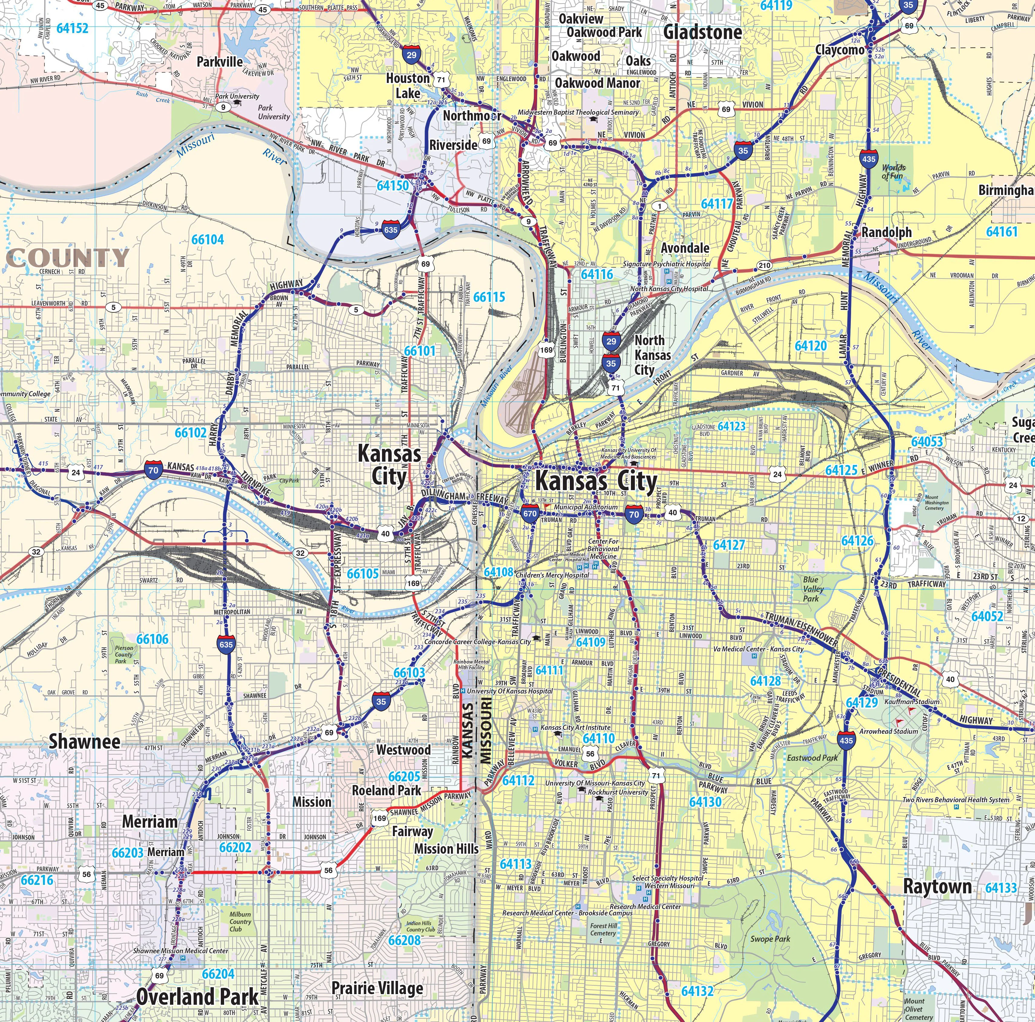
Kansas City Metro Area wall map, showing locations within 30 - 40 miles of downtown Kansas City. Information shown includes counties, towns, cities, major roads and highways, ZIP codes, and major points of interest. The area shown is from Lawrence, KS to Odessa, MO, and from Smithville to Harrisonville, MO. An index of community names is included
This map comes in a variety of sizes and finishing options. It is shipped rolled in a sturdy cardboard tube.
Product Information
Product Information
Shipping & Returns
Shipping & Returns


Kansas City Metro Area Wall Map
Kansas City Metro Area Wall Map
Kansas City Metro Area wall map, showing locations within 30 - 40 miles of downtown Kansas City. Information shown includes counties, towns, cities, major roads and highways, ZIP codes, and major points of interest. The area shown is from Lawrence, KS to Odessa, MO, and from Smithville to Harrisonville, MO. An index of community names is included
This map comes in a variety of sizes and finishing options. It is shipped rolled in a sturdy cardboard tube.
Original: $79.95
-65%$79.95
$27.98Product Information
Product Information
Shipping & Returns
Shipping & Returns
Description
Kansas City Metro Area wall map, showing locations within 30 - 40 miles of downtown Kansas City. Information shown includes counties, towns, cities, major roads and highways, ZIP codes, and major points of interest. The area shown is from Lawrence, KS to Odessa, MO, and from Smithville to Harrisonville, MO. An index of community names is included
This map comes in a variety of sizes and finishing options. It is shipped rolled in a sturdy cardboard tube.