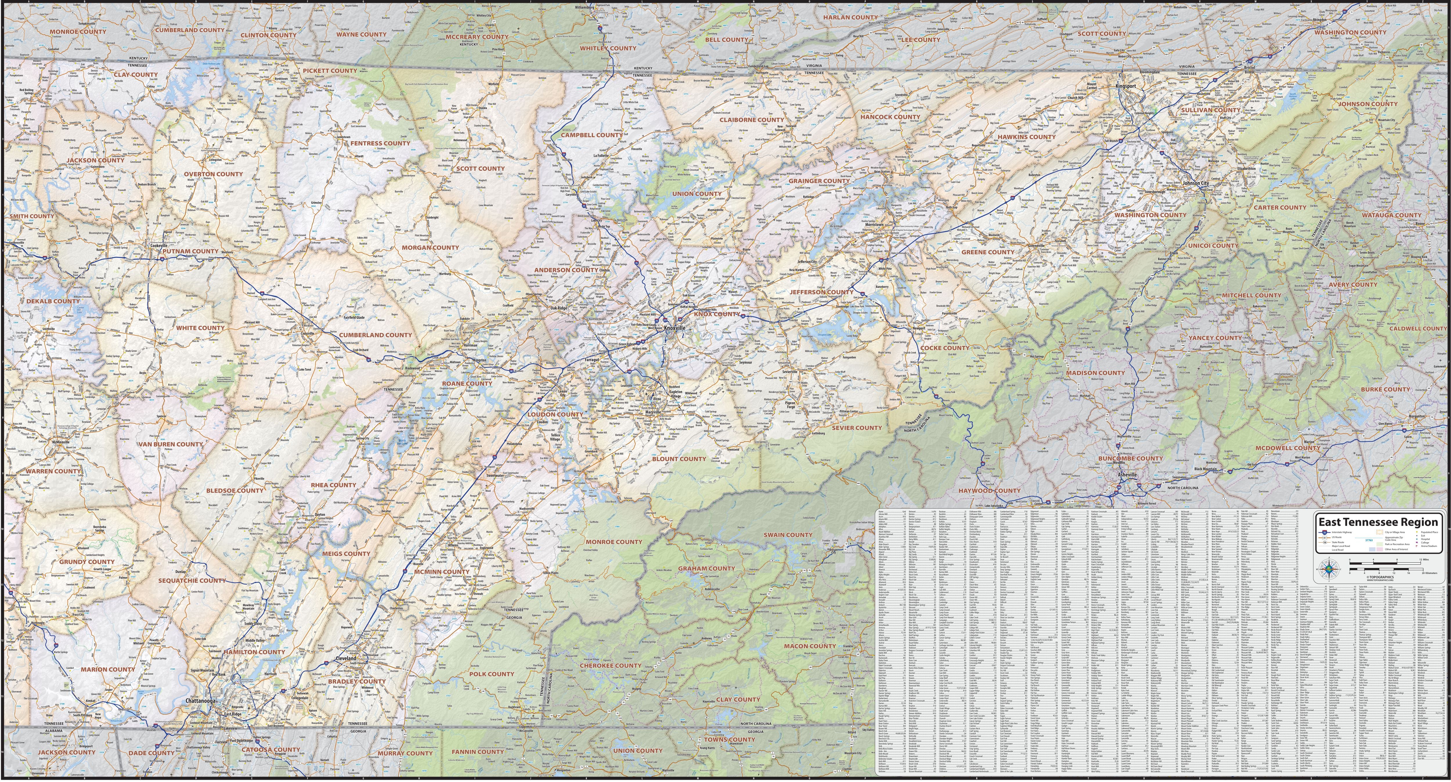
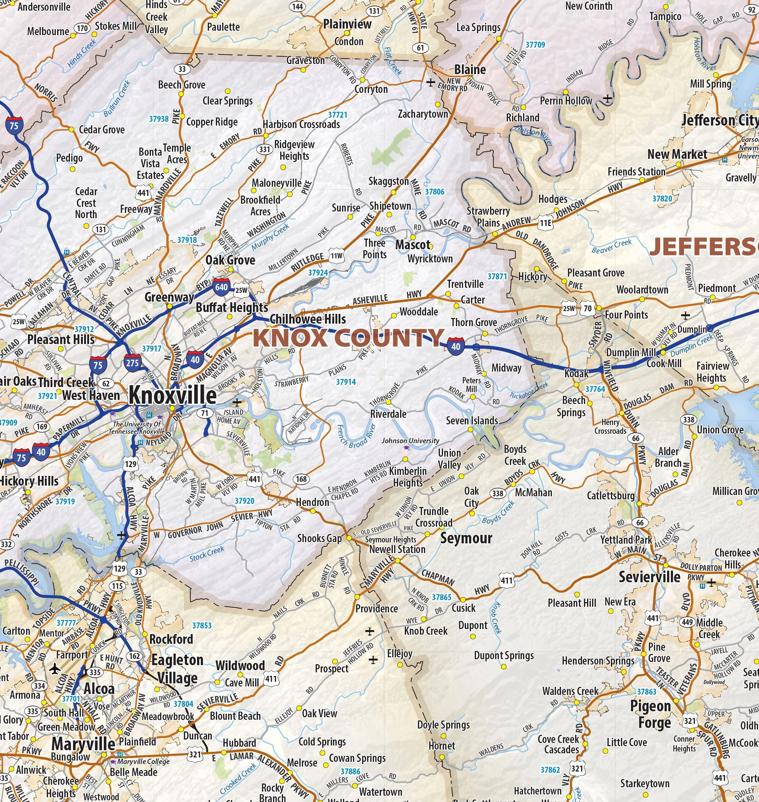
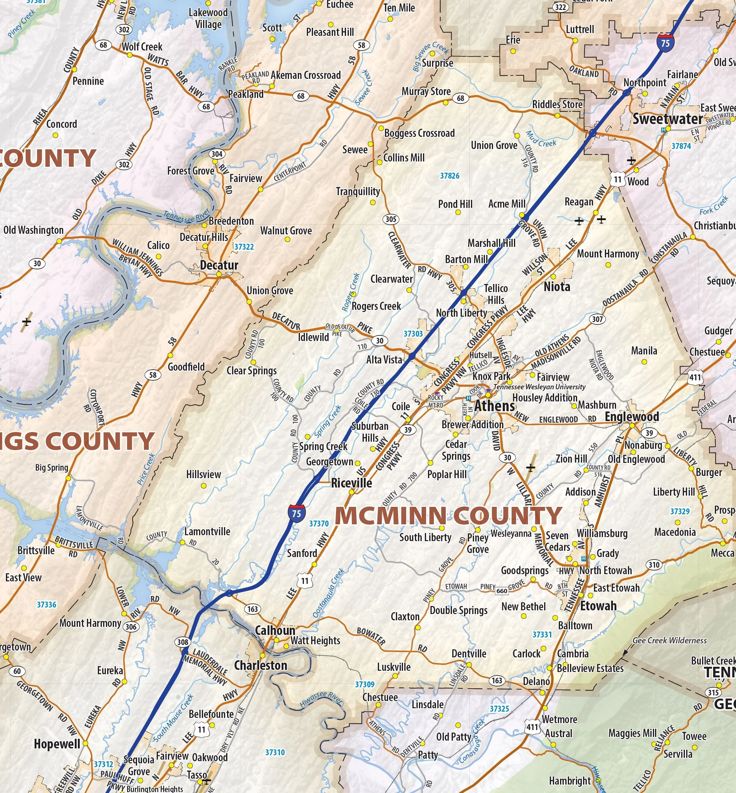
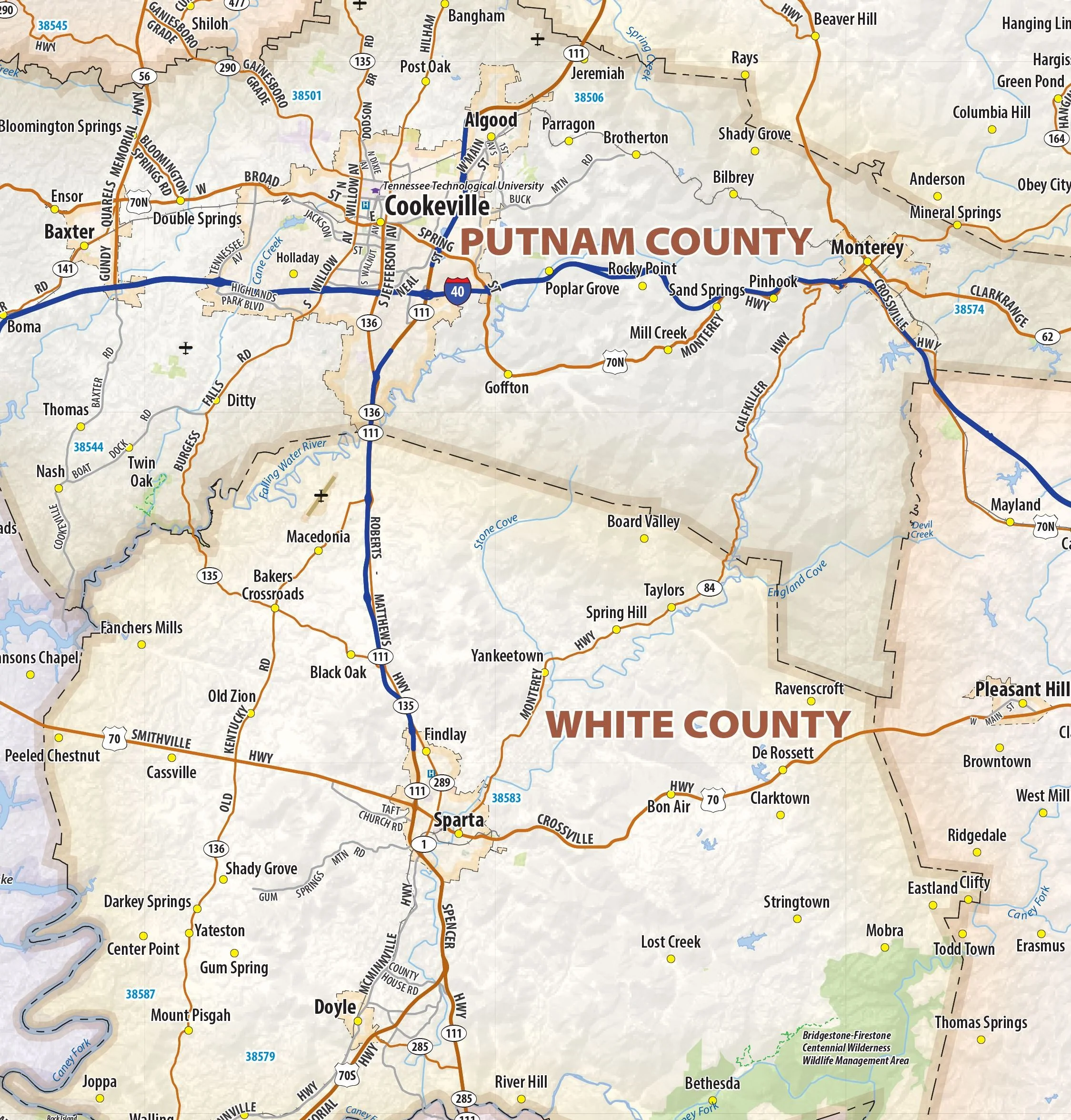
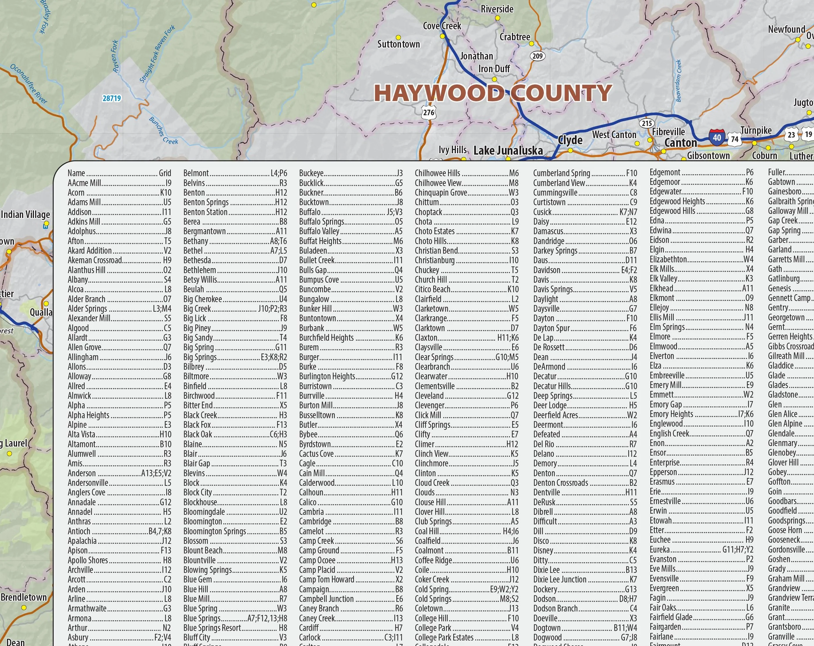
East Tennessee Regional Area Wall Map
Our East Tennessee Regional Wall Map shows the area of Tennessee from Chattanooga in the west to the state line in the east, including the counties of Anderson, Bledsoe, Blount, Bradley, Campbell, Carter, Claiborne, Clay, Cocke, Cumberland, Frntress, Granger, Hamilton, Hancock, Hawkins, Jackson, Jefferson, Johnson, Knox, Loudon, Marion, McMinn, Meigs, Monroe, Morgan, Overton, Pickett, Polk, Putnam, Rhea, Roane, Scott, Sequatchie, Sevier, Sullivan, Unicoi, Union, Van Buren, Washington, and White
This map is rolled and shipped in a sturdy cardboard tube.
Product Information
Product Information
Shipping & Returns
Shipping & Returns

East Tennessee Regional Area Wall Map
East Tennessee Regional Area Wall Map
Our East Tennessee Regional Wall Map shows the area of Tennessee from Chattanooga in the west to the state line in the east, including the counties of Anderson, Bledsoe, Blount, Bradley, Campbell, Carter, Claiborne, Clay, Cocke, Cumberland, Frntress, Granger, Hamilton, Hancock, Hawkins, Jackson, Jefferson, Johnson, Knox, Loudon, Marion, McMinn, Meigs, Monroe, Morgan, Overton, Pickett, Polk, Putnam, Rhea, Roane, Scott, Sequatchie, Sevier, Sullivan, Unicoi, Union, Van Buren, Washington, and White
This map is rolled and shipped in a sturdy cardboard tube.
Original: $79.95
-65%$79.95
$27.98Product Information
Product Information
Shipping & Returns
Shipping & Returns
Description
Our East Tennessee Regional Wall Map shows the area of Tennessee from Chattanooga in the west to the state line in the east, including the counties of Anderson, Bledsoe, Blount, Bradley, Campbell, Carter, Claiborne, Clay, Cocke, Cumberland, Frntress, Granger, Hamilton, Hancock, Hawkins, Jackson, Jefferson, Johnson, Knox, Loudon, Marion, McMinn, Meigs, Monroe, Morgan, Overton, Pickett, Polk, Putnam, Rhea, Roane, Scott, Sequatchie, Sevier, Sullivan, Unicoi, Union, Van Buren, Washington, and White
This map is rolled and shipped in a sturdy cardboard tube.


