🚚 Free Worldwide Shipping on All Orders!Shop Now
Willamette Valley Oregon Wall Map
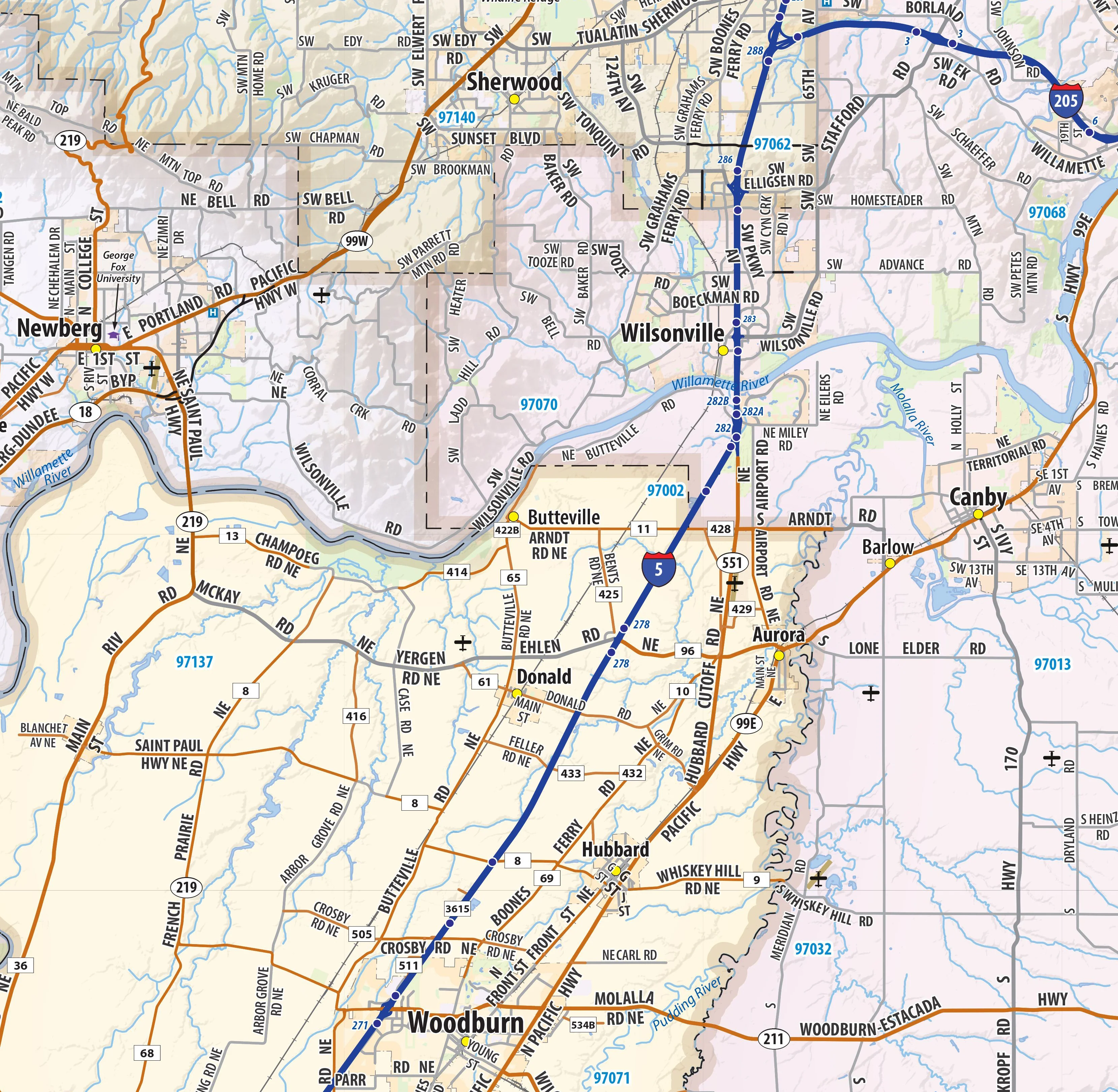
Our Willamette Valley wall map shows the entire 120 mile long Willamette Valley, from Portland in the north to Eugene in the south, including the cities of Albany, Corvallis, Lebanon, Salem, Woodburn, McMinnville, Oregon City, West Linn, and many others. The map shows towns, counties, major and secondary highways and routes, as well as major points of interest. Note: due to the vast extent of this map, local street names are not shown.
This map comes in a variety of sizes and finishing options. It is shipped rolled in a sturdy cardboard tube.
Product Information
Product Information
Shipping & Returns
Shipping & Returns


Willamette Valley Oregon Wall Map
Willamette Valley Oregon Wall Map
Our Willamette Valley wall map shows the entire 120 mile long Willamette Valley, from Portland in the north to Eugene in the south, including the cities of Albany, Corvallis, Lebanon, Salem, Woodburn, McMinnville, Oregon City, West Linn, and many others. The map shows towns, counties, major and secondary highways and routes, as well as major points of interest. Note: due to the vast extent of this map, local street names are not shown.
This map comes in a variety of sizes and finishing options. It is shipped rolled in a sturdy cardboard tube.
Select Size
Select Material
From $34.98
Original: $99.95
-65%Willamette Valley Oregon Wall Map—
$99.95
$34.98Product Information
Product Information
Shipping & Returns
Shipping & Returns
Description
Our Willamette Valley wall map shows the entire 120 mile long Willamette Valley, from Portland in the north to Eugene in the south, including the cities of Albany, Corvallis, Lebanon, Salem, Woodburn, McMinnville, Oregon City, West Linn, and many others. The map shows towns, counties, major and secondary highways and routes, as well as major points of interest. Note: due to the vast extent of this map, local street names are not shown.
This map comes in a variety of sizes and finishing options. It is shipped rolled in a sturdy cardboard tube.

