Southwestern USA Wall Map
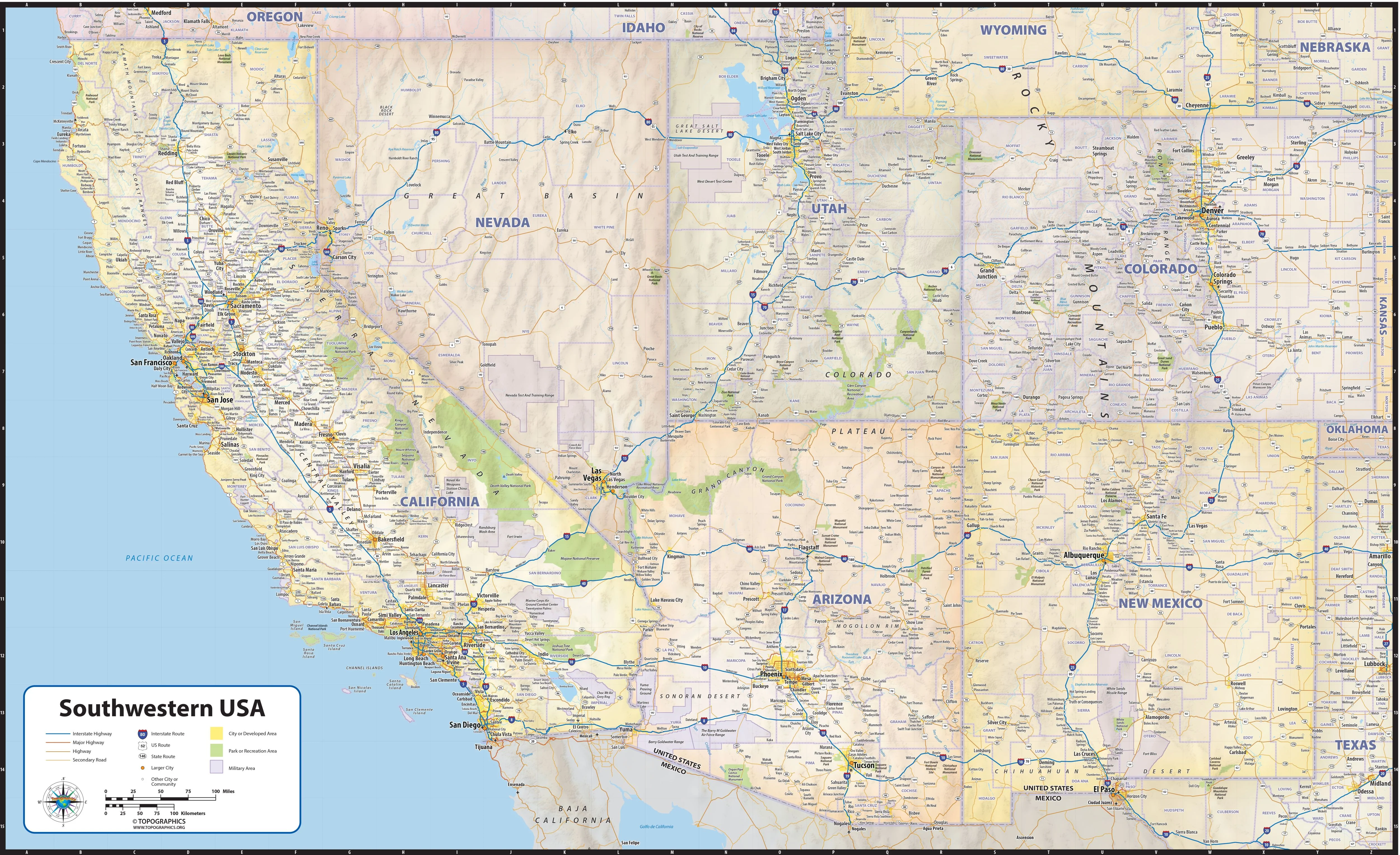
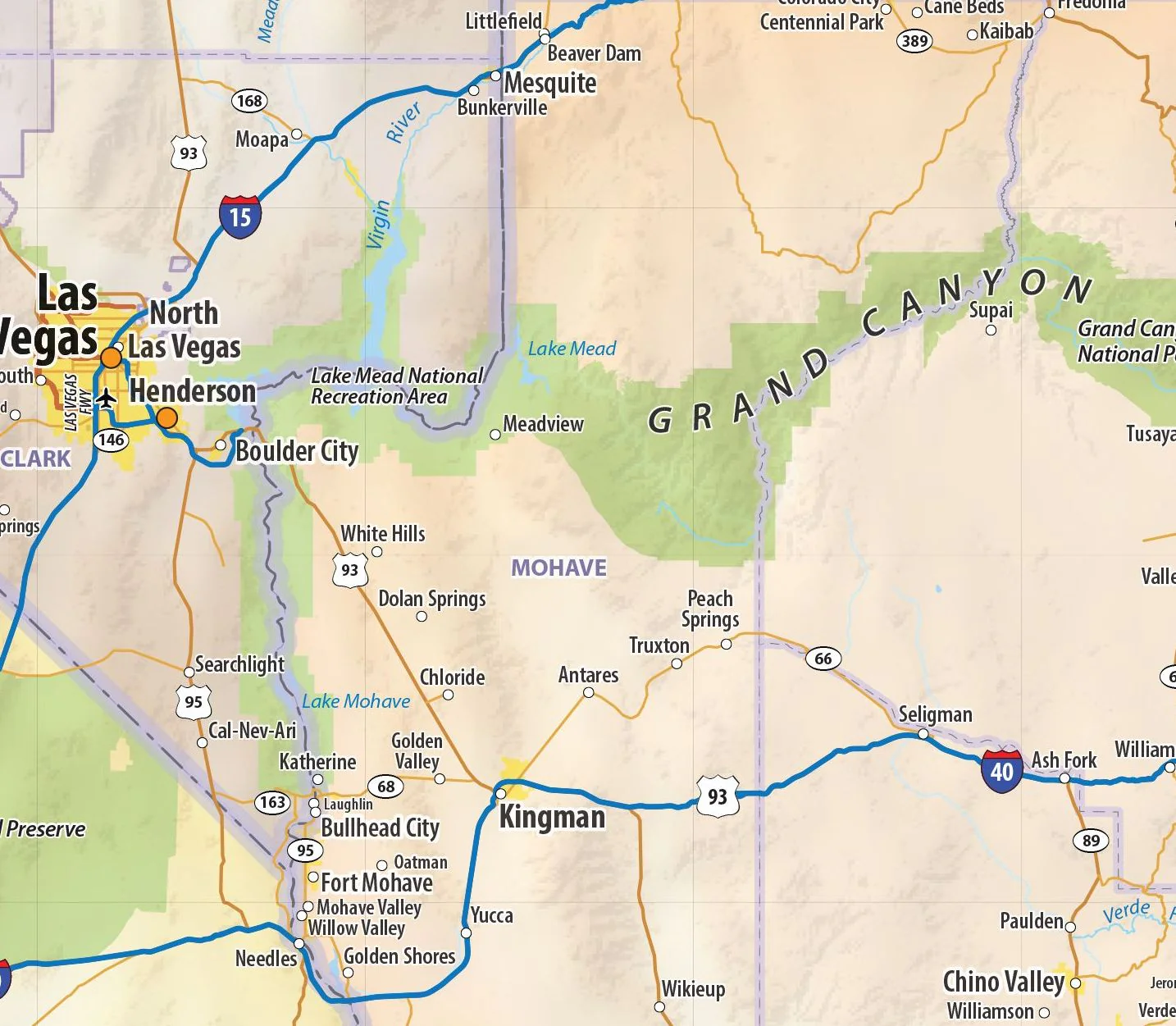
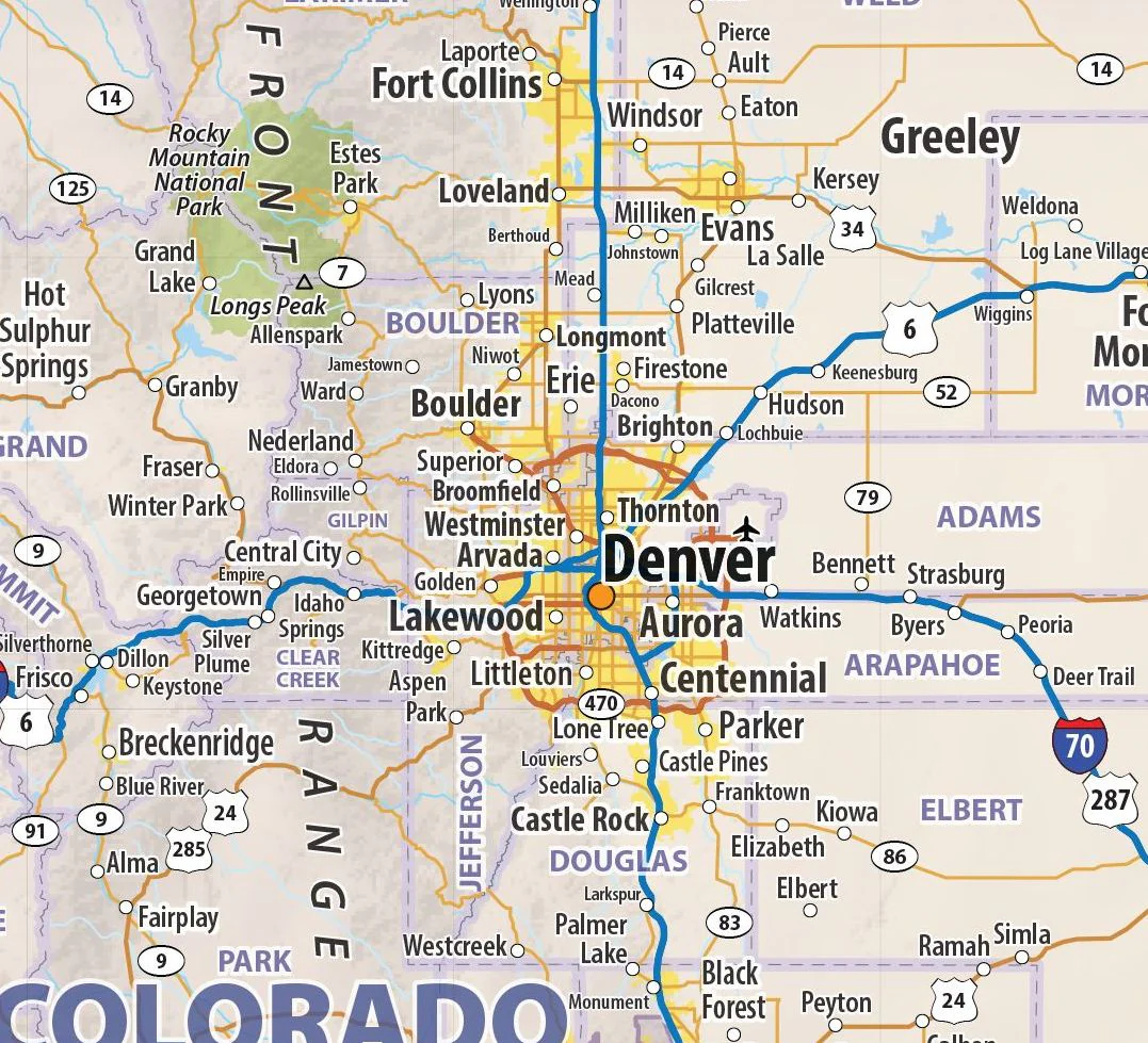
Our Southwestern United States regional wall map shows the states of California, Nevada, Utah, Colorado, Arizona, and New Mexico. Features shown include states, cities, towns, counties, and major highways. The entire 6 state area from the Pacific to the Rockies, and from Salt Lake City to the Mexican border is shown.
This map is available in multiple sizes and finishing options and comes rolled and shipped in a sturdy cardboard tube.
Product Information
Product Information
Shipping & Returns
Shipping & Returns


Southwestern USA Wall Map
Southwestern USA Wall Map
Our Southwestern United States regional wall map shows the states of California, Nevada, Utah, Colorado, Arizona, and New Mexico. Features shown include states, cities, towns, counties, and major highways. The entire 6 state area from the Pacific to the Rockies, and from Salt Lake City to the Mexican border is shown.
This map is available in multiple sizes and finishing options and comes rolled and shipped in a sturdy cardboard tube.
Original: $79.95
-65%$79.95
$27.98Product Information
Product Information
Shipping & Returns
Shipping & Returns
Description
Our Southwestern United States regional wall map shows the states of California, Nevada, Utah, Colorado, Arizona, and New Mexico. Features shown include states, cities, towns, counties, and major highways. The entire 6 state area from the Pacific to the Rockies, and from Salt Lake City to the Mexican border is shown.
This map is available in multiple sizes and finishing options and comes rolled and shipped in a sturdy cardboard tube.


