🚚 Free Worldwide Shipping on All Orders!Shop Now
Pittsburgh and SW Pennsylvania
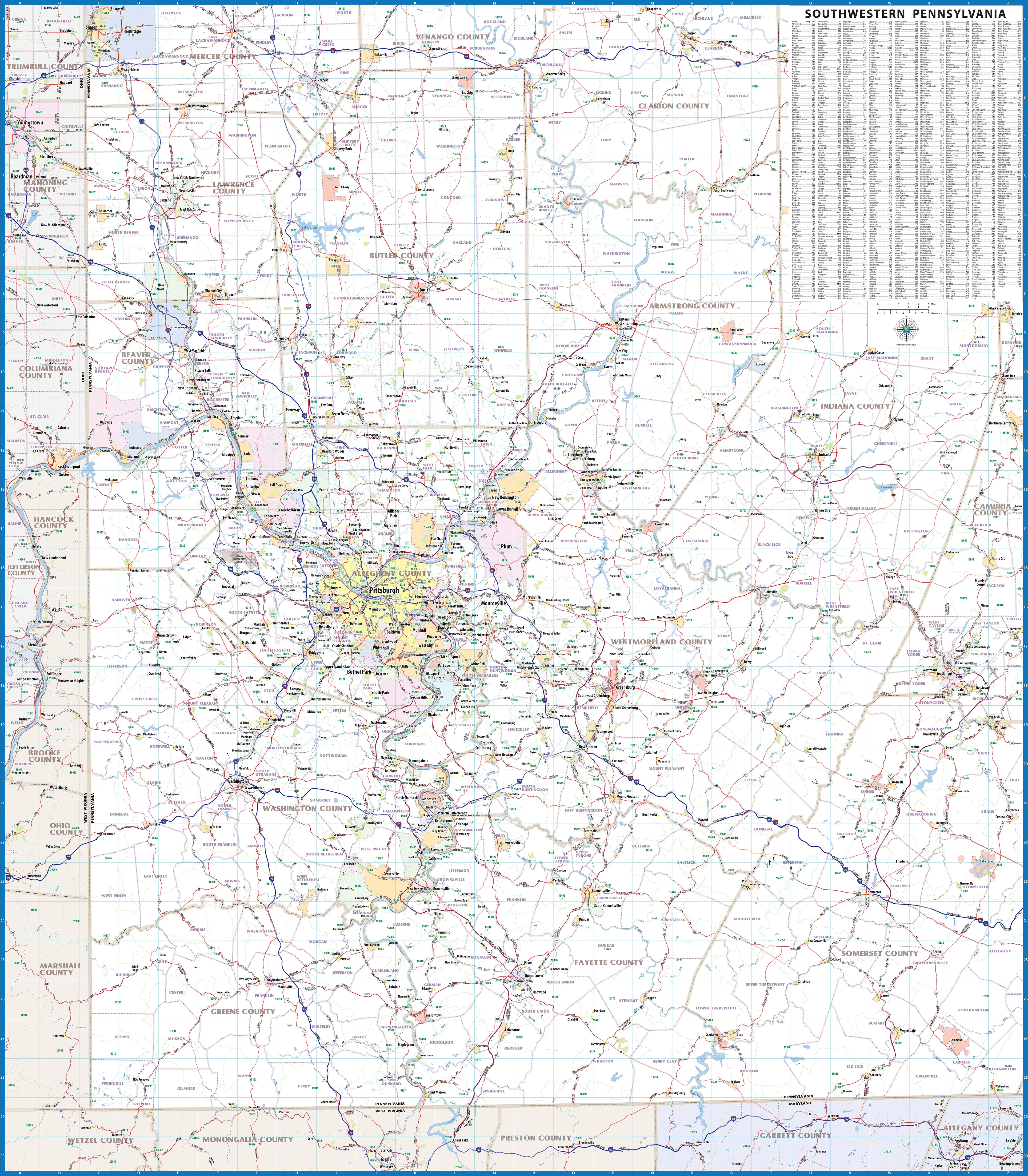
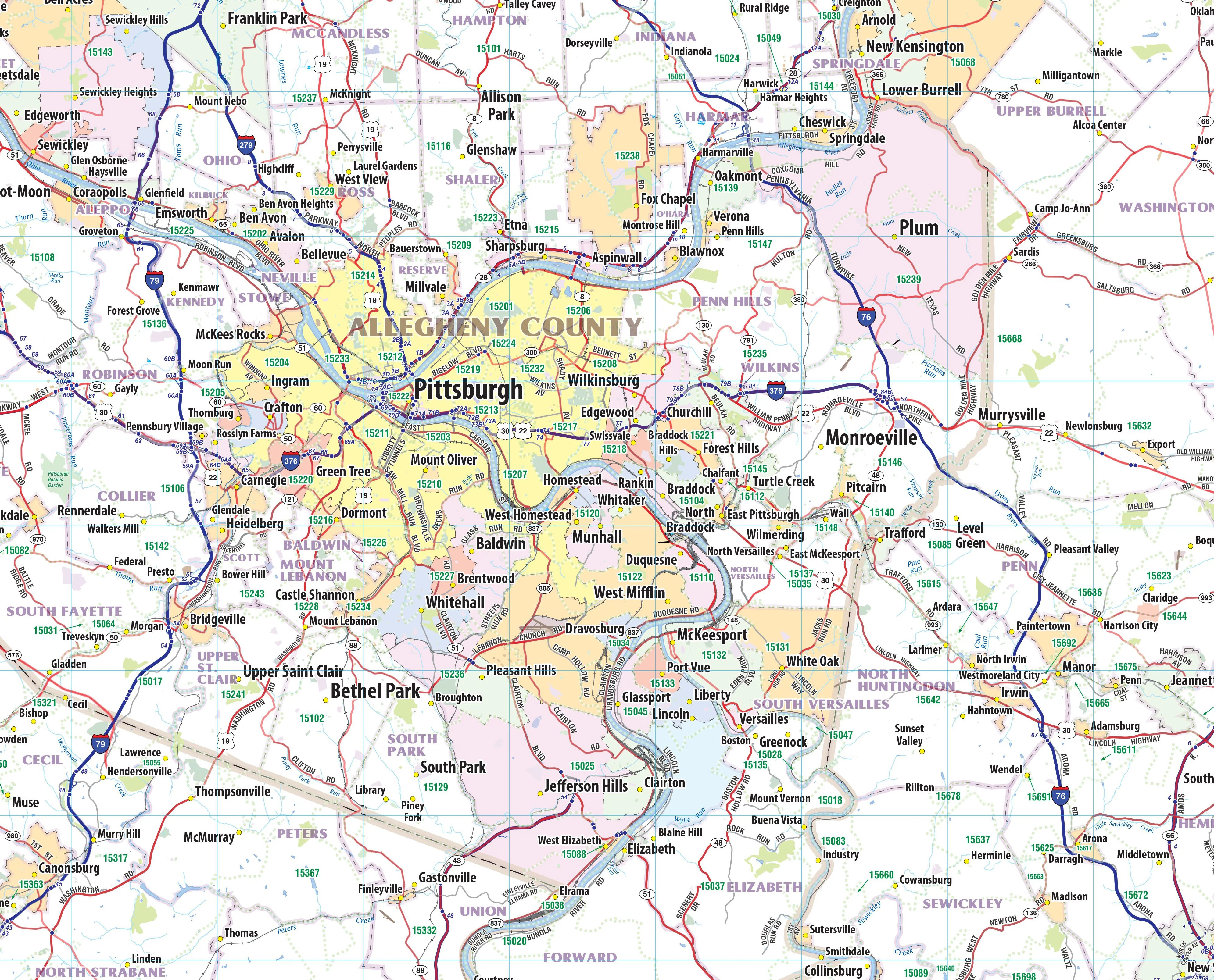
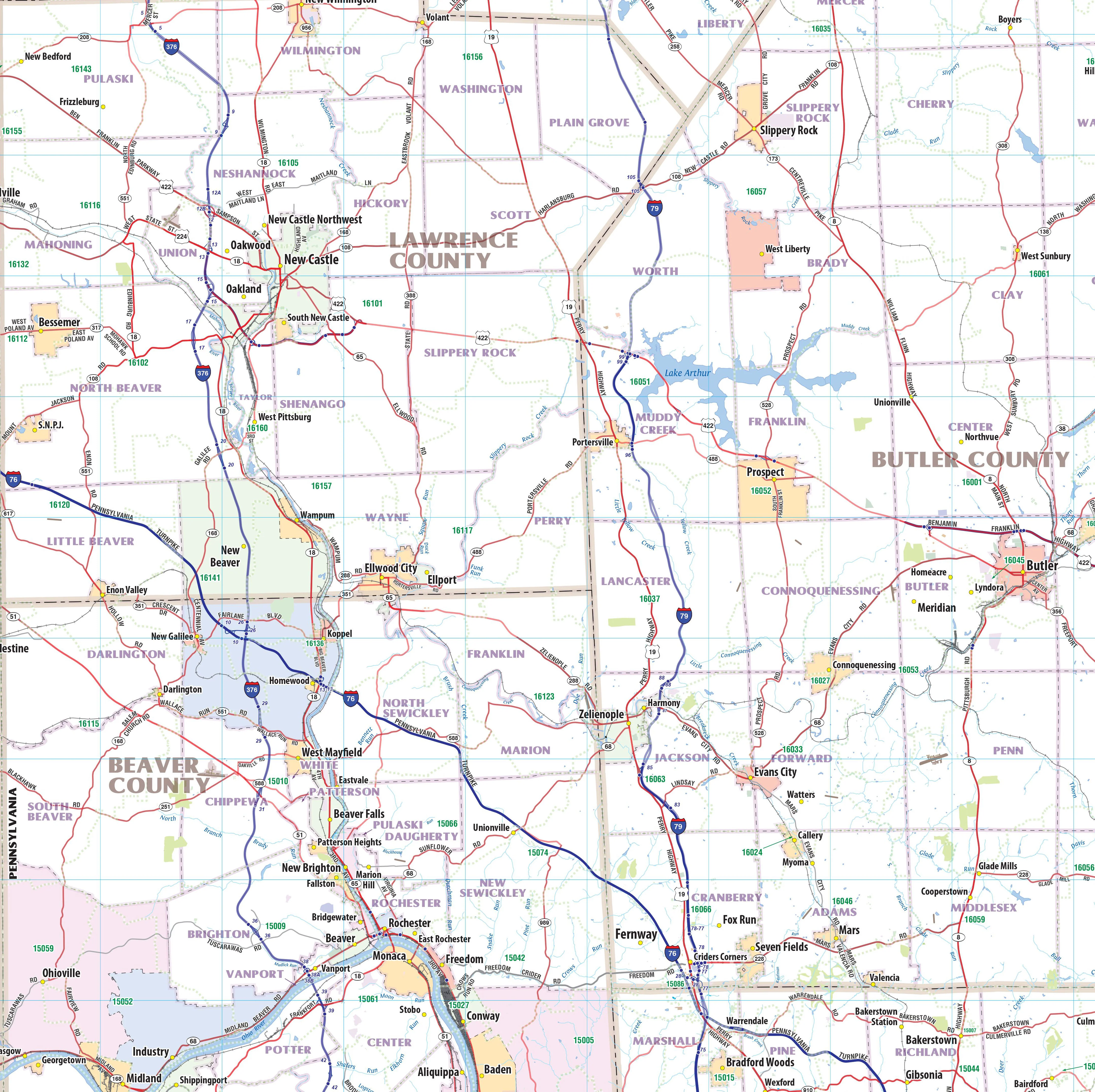
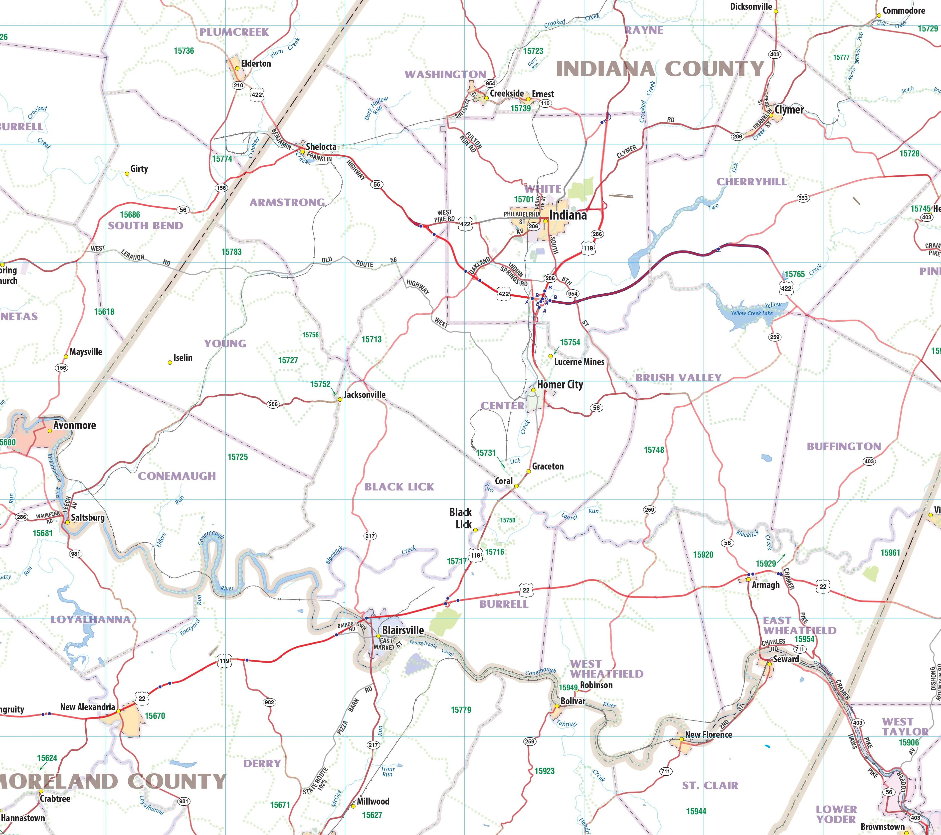
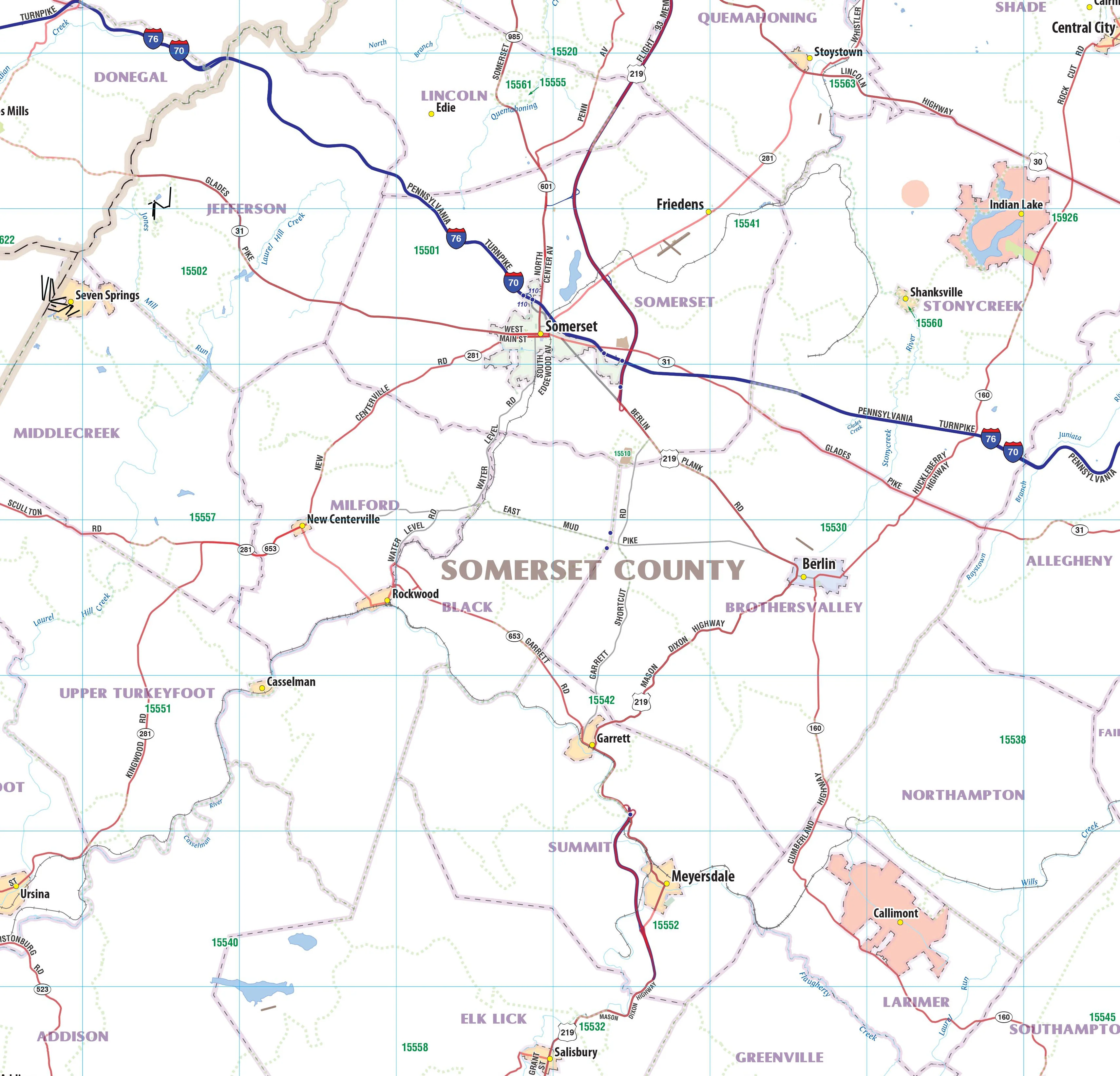
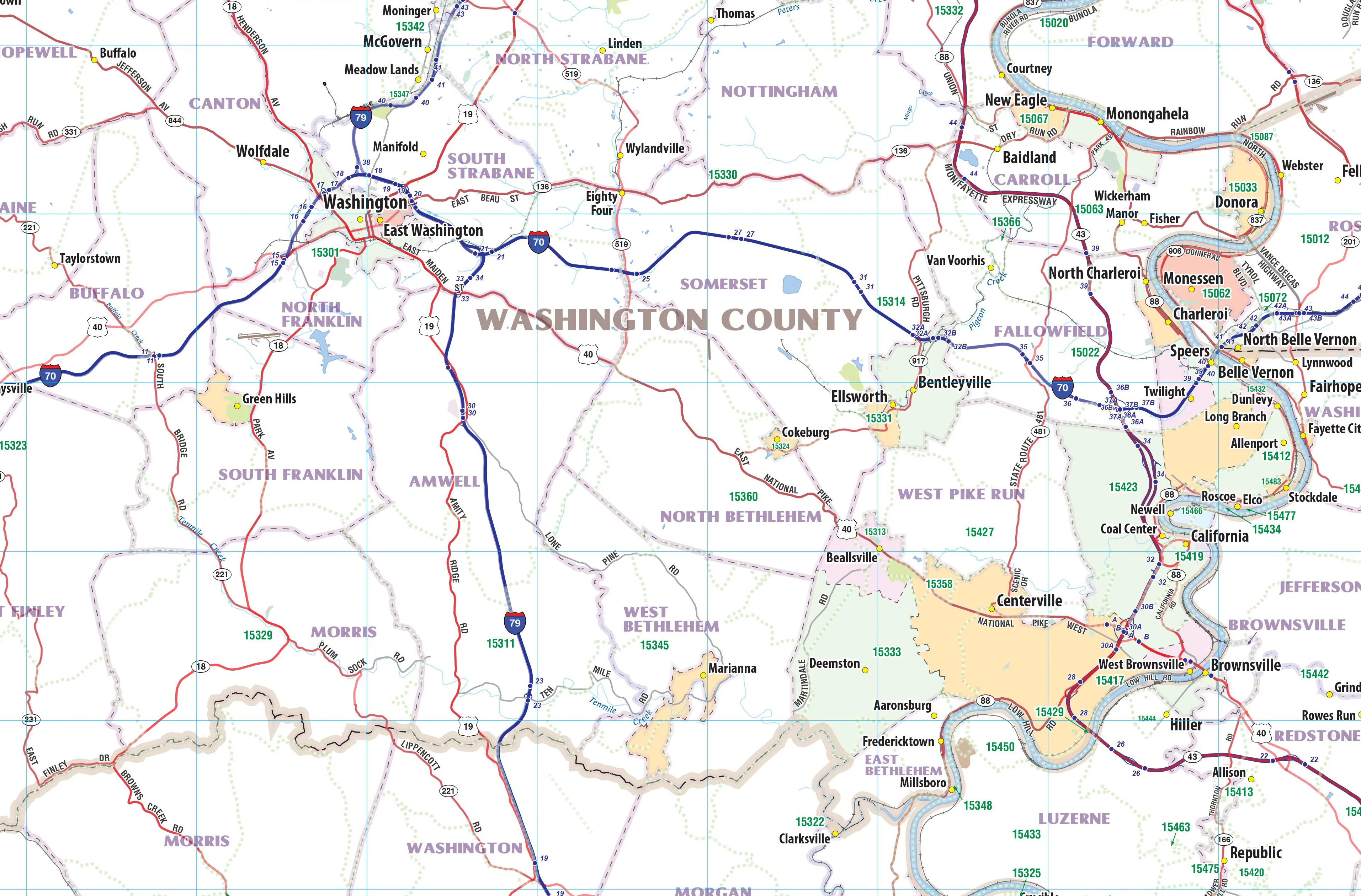
Wall map of the Pittsburgh Metro Area showing locations within 35 - 60 miles of downtown Pittsburgh, including all of southwestern Pennsylvania. The map covers Allegheny, Lawrence, Butler, Armstrong, Indiana, Westmoreland, Fayette, Washington, Greene, and Butler Counties, as well as the immediate adjacent areas of Pennsylvania, West Virginia, Ohio, and Maryland.
Features shown include cities, towns, major roads and highways, and zip codes. An index of community names is included.
This map comes in a variety of sizes and finishing options. It is shipped rolled in a sturdy cardboard tube.
Product Information
Product Information
Shipping & Returns
Shipping & Returns
Pittsburgh and SW Pennsylvania
Pittsburgh and SW Pennsylvania
Wall map of the Pittsburgh Metro Area showing locations within 35 - 60 miles of downtown Pittsburgh, including all of southwestern Pennsylvania. The map covers Allegheny, Lawrence, Butler, Armstrong, Indiana, Westmoreland, Fayette, Washington, Greene, and Butler Counties, as well as the immediate adjacent areas of Pennsylvania, West Virginia, Ohio, and Maryland.
Features shown include cities, towns, major roads and highways, and zip codes. An index of community names is included.
This map comes in a variety of sizes and finishing options. It is shipped rolled in a sturdy cardboard tube.
Select Size
Select Material
From $27.98
Original: $79.95
-65%Pittsburgh and SW Pennsylvania—
$79.95
$27.98Product Information
Product Information
Shipping & Returns
Shipping & Returns
Description
Wall map of the Pittsburgh Metro Area showing locations within 35 - 60 miles of downtown Pittsburgh, including all of southwestern Pennsylvania. The map covers Allegheny, Lawrence, Butler, Armstrong, Indiana, Westmoreland, Fayette, Washington, Greene, and Butler Counties, as well as the immediate adjacent areas of Pennsylvania, West Virginia, Ohio, and Maryland.
Features shown include cities, towns, major roads and highways, and zip codes. An index of community names is included.
This map comes in a variety of sizes and finishing options. It is shipped rolled in a sturdy cardboard tube.