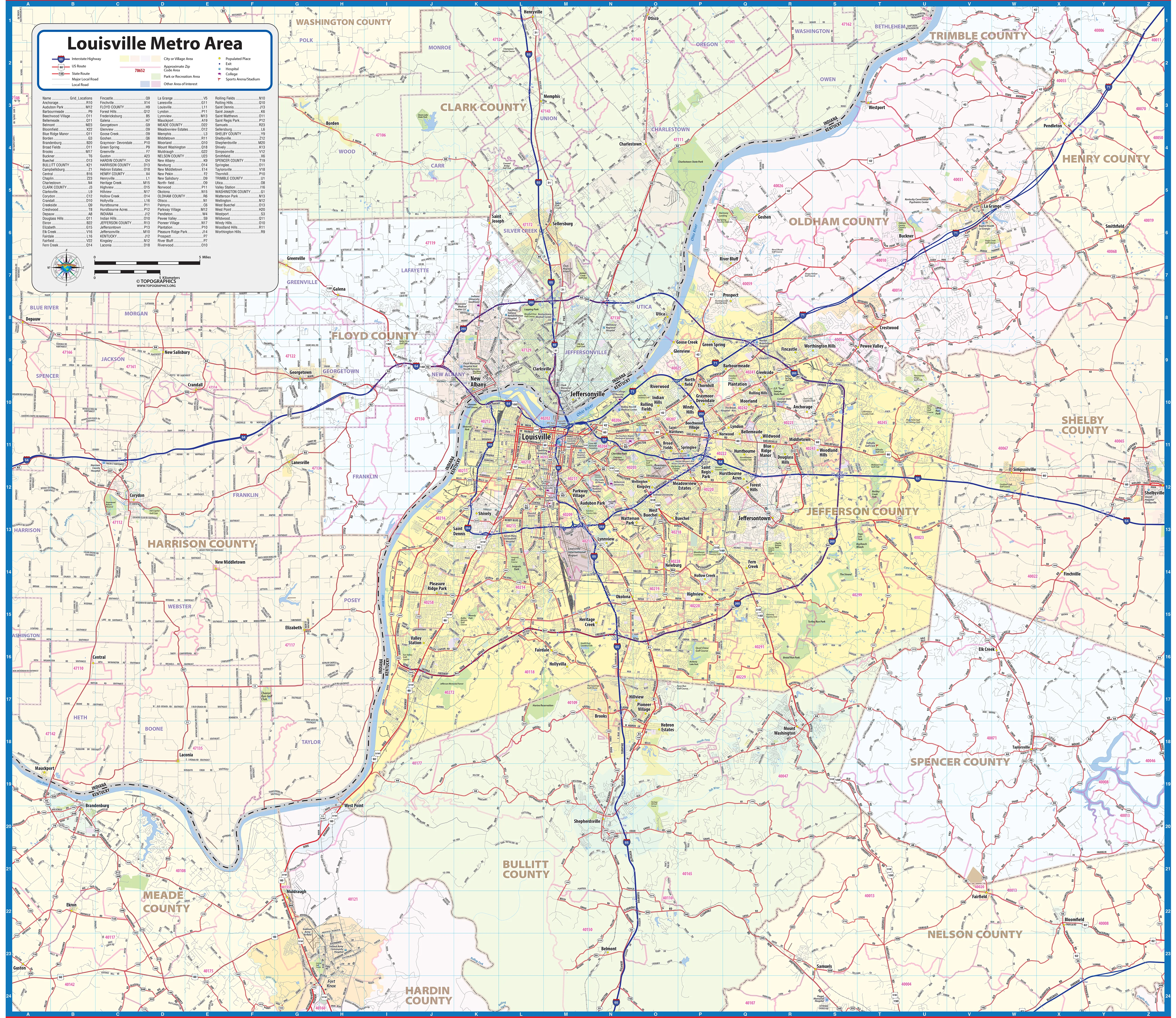
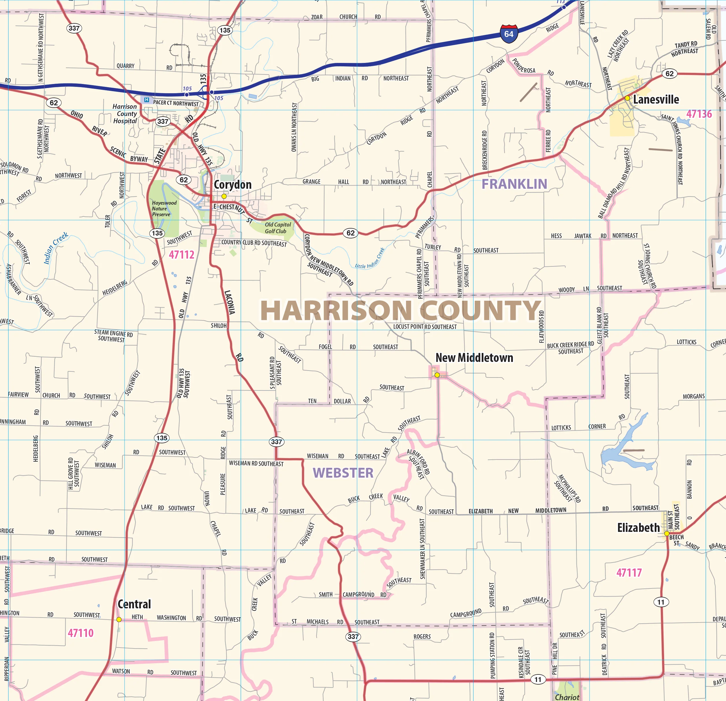
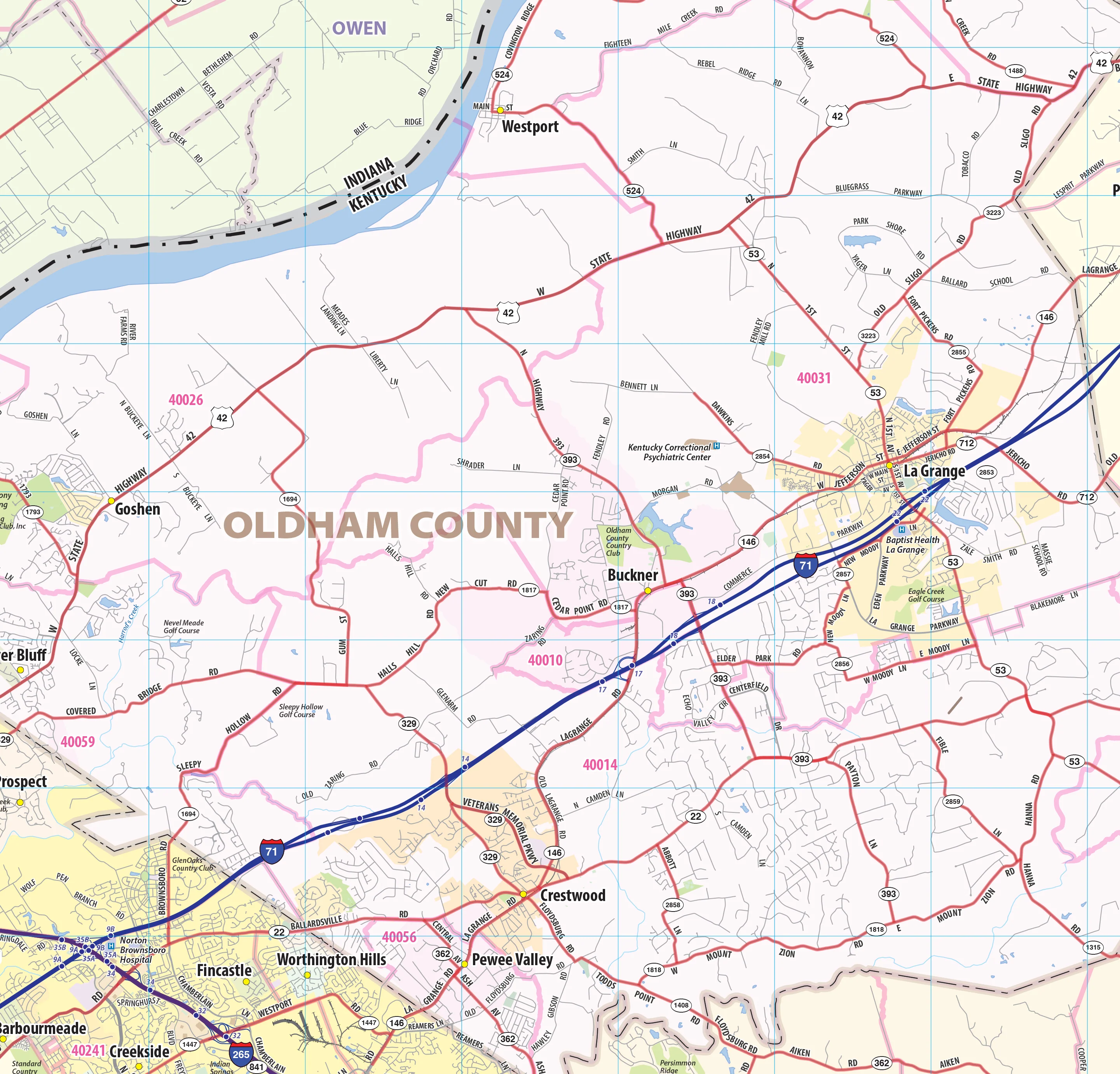
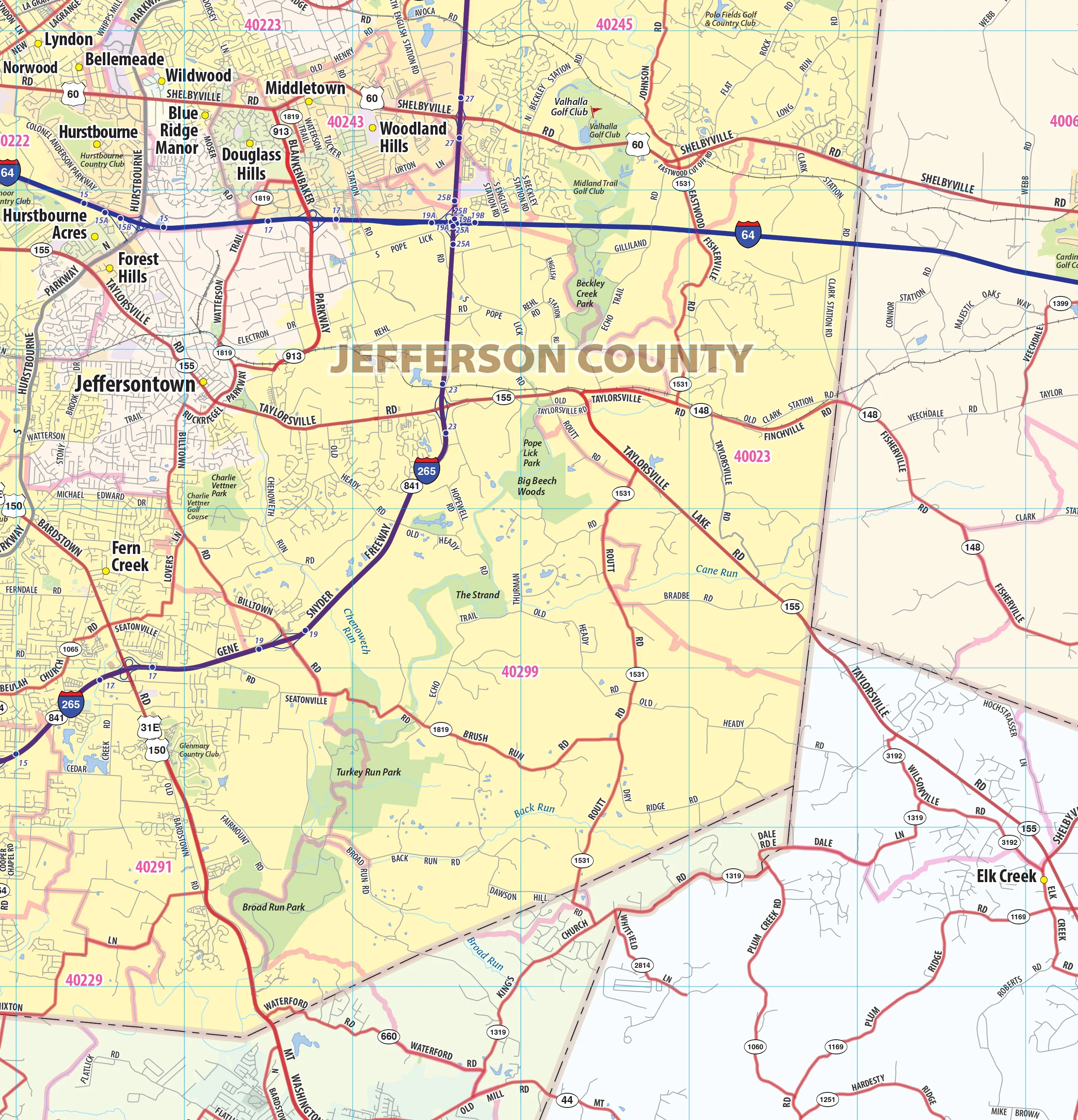
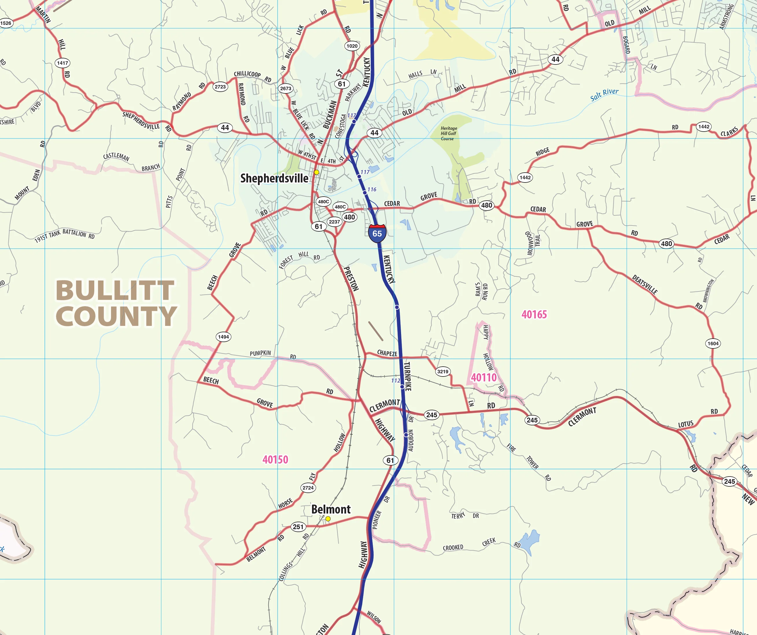
Louisville Metro Area Wall Map
Our Louisville Metro Area wall map shows the area within 25 miles of downtown Louisville for areas both in Kentucky and Indiana, including the communities of Jeffersontown, Jeffersonville, New Albany, Clarksville, Lyndon, Mount Washington, St. Matthews, Shelbyville, Shepherdsville, and Shively, among others. All of Jefferson County, Oldham County, and Floyd County are shown, as well as adjacent areas of nearby counties. Features shown include cities, towns, counties, highways and major and secondary roads, zip codes, and major points of interest. Note: due to the vast extent of this map, local street names are not shown.
This map comes in a variety of sizes and finishing options. It is shipped rolled in a sturdy cardboard tube.
Product Information
Product Information
Shipping & Returns
Shipping & Returns

Louisville Metro Area Wall Map
Louisville Metro Area Wall Map
Our Louisville Metro Area wall map shows the area within 25 miles of downtown Louisville for areas both in Kentucky and Indiana, including the communities of Jeffersontown, Jeffersonville, New Albany, Clarksville, Lyndon, Mount Washington, St. Matthews, Shelbyville, Shepherdsville, and Shively, among others. All of Jefferson County, Oldham County, and Floyd County are shown, as well as adjacent areas of nearby counties. Features shown include cities, towns, counties, highways and major and secondary roads, zip codes, and major points of interest. Note: due to the vast extent of this map, local street names are not shown.
This map comes in a variety of sizes and finishing options. It is shipped rolled in a sturdy cardboard tube.
Original: $79.95
-65%$79.95
$27.98Product Information
Product Information
Shipping & Returns
Shipping & Returns
Description
Our Louisville Metro Area wall map shows the area within 25 miles of downtown Louisville for areas both in Kentucky and Indiana, including the communities of Jeffersontown, Jeffersonville, New Albany, Clarksville, Lyndon, Mount Washington, St. Matthews, Shelbyville, Shepherdsville, and Shively, among others. All of Jefferson County, Oldham County, and Floyd County are shown, as well as adjacent areas of nearby counties. Features shown include cities, towns, counties, highways and major and secondary roads, zip codes, and major points of interest. Note: due to the vast extent of this map, local street names are not shown.
This map comes in a variety of sizes and finishing options. It is shipped rolled in a sturdy cardboard tube.