🚚 Free Worldwide Shipping on All Orders!Shop Now
Greater Portland Metro Area Wall Map
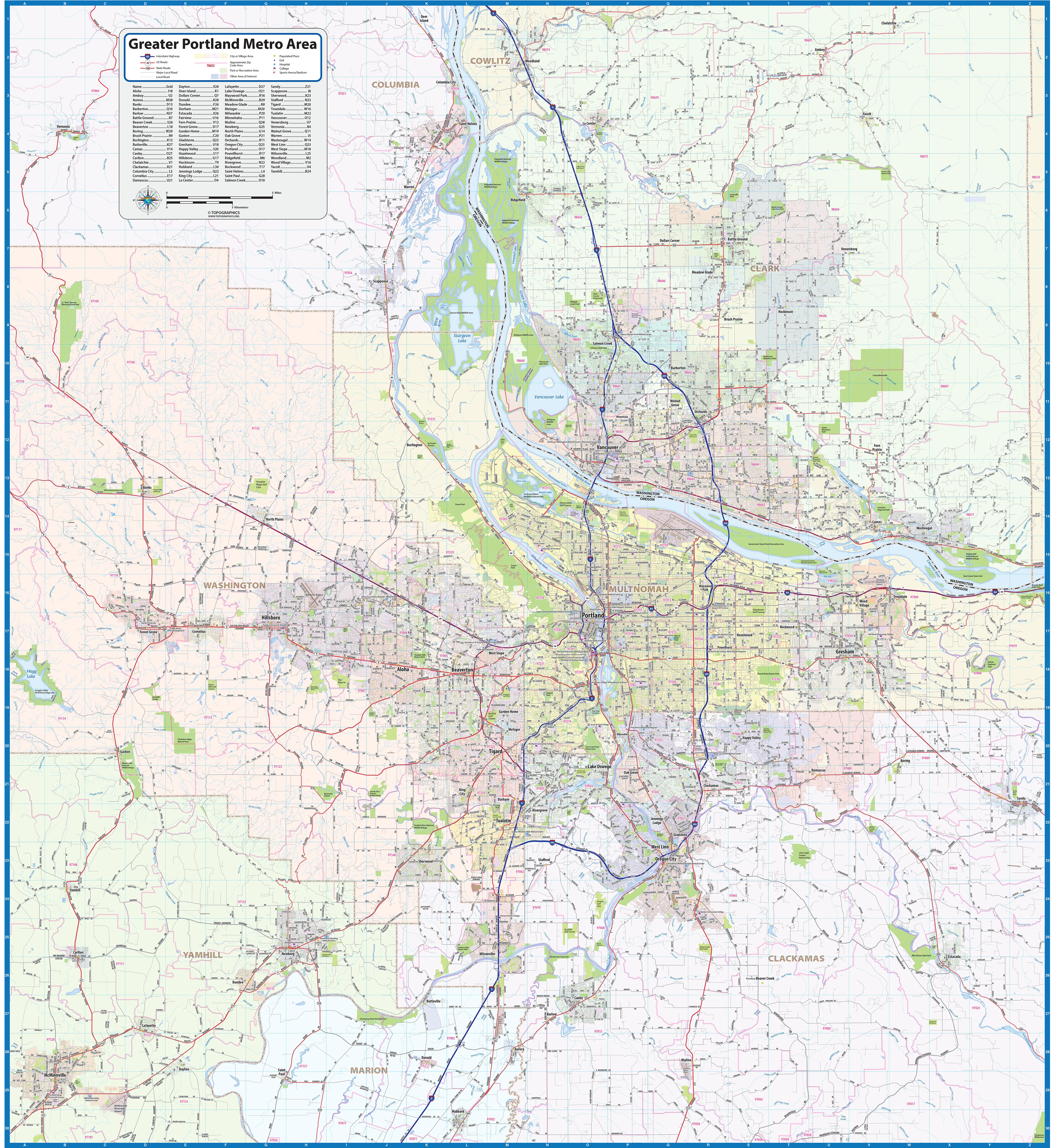
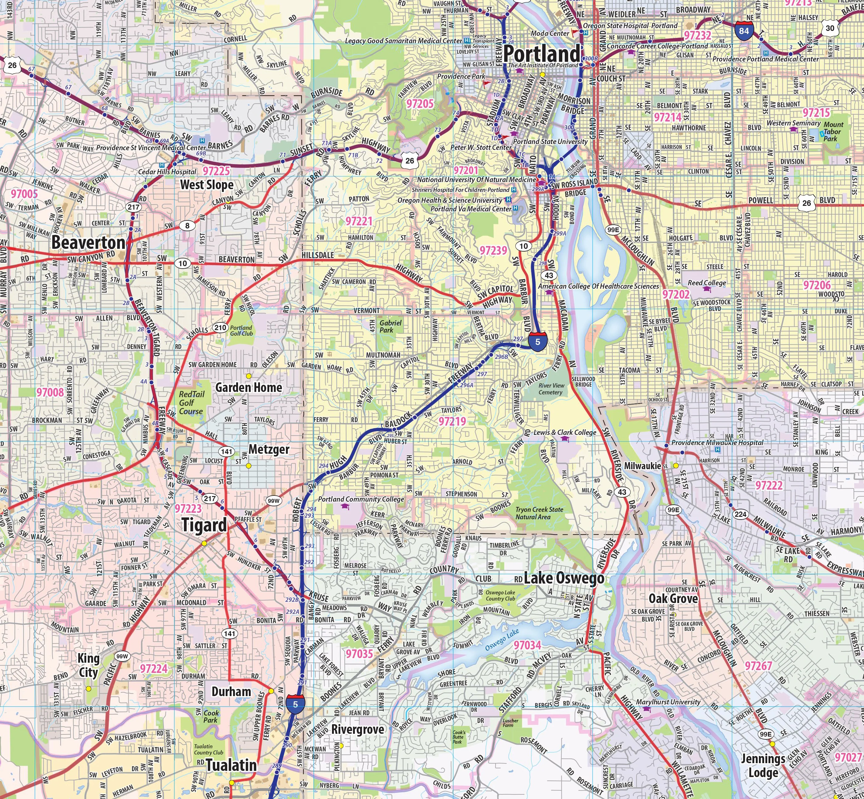
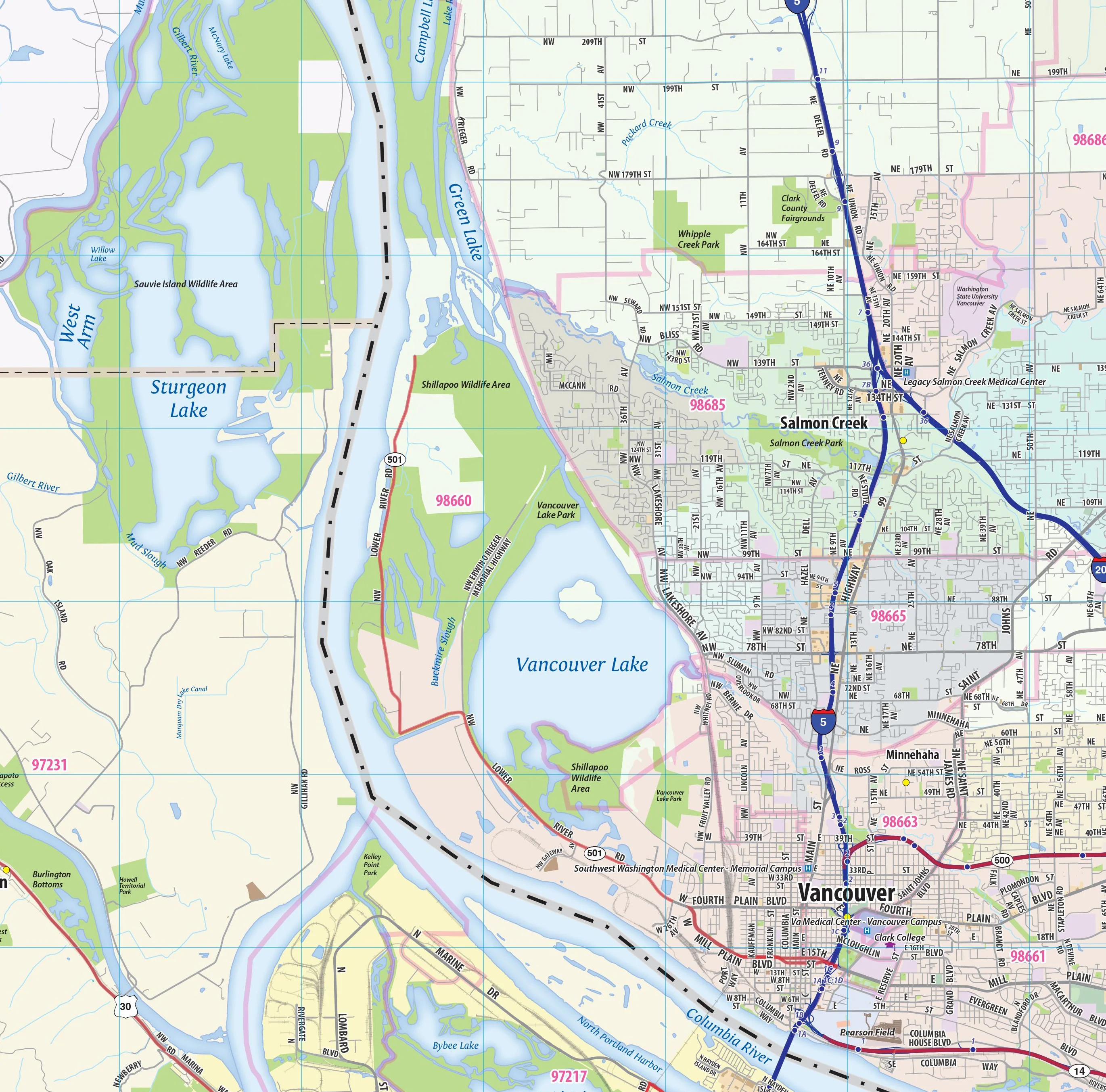
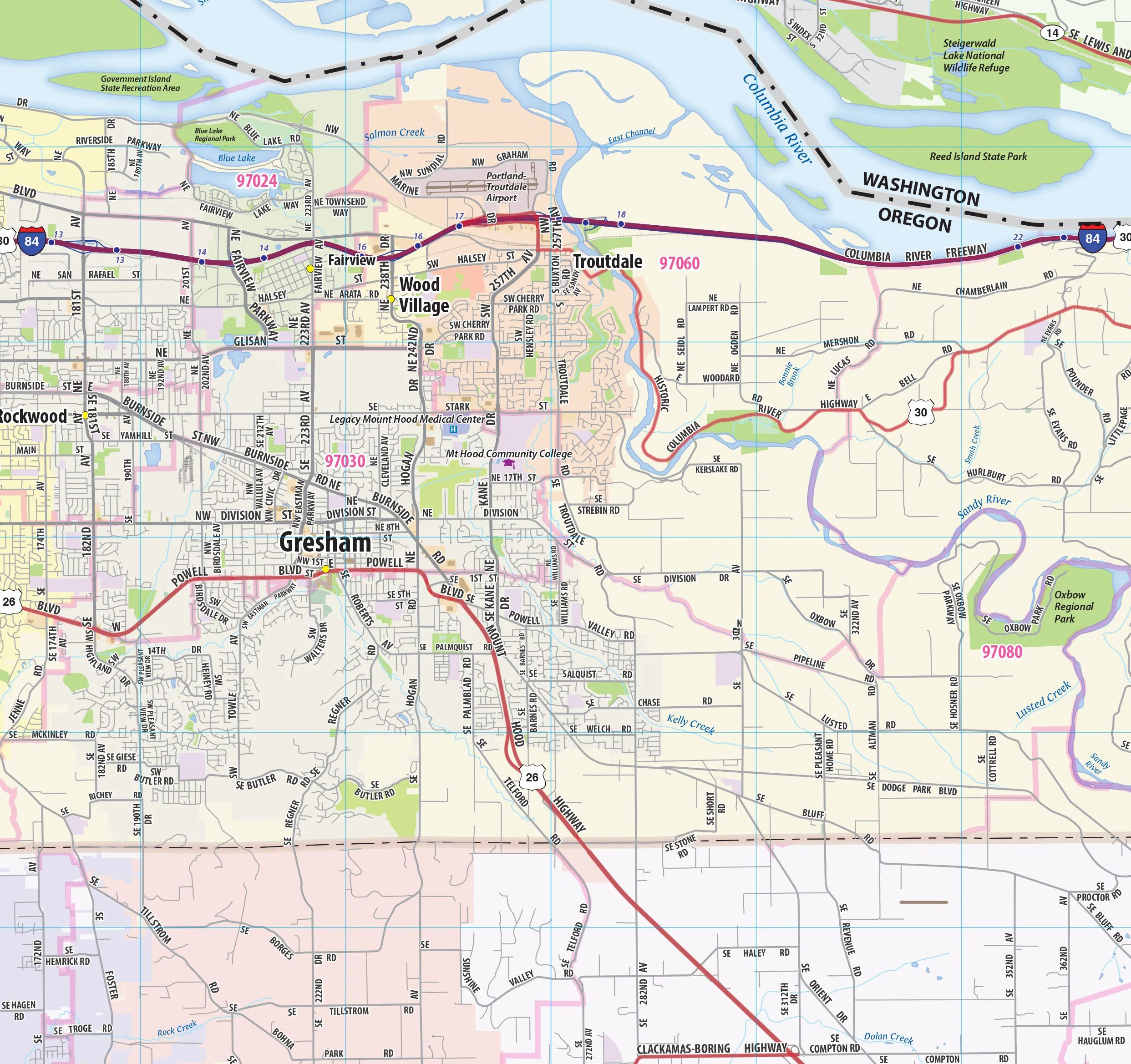
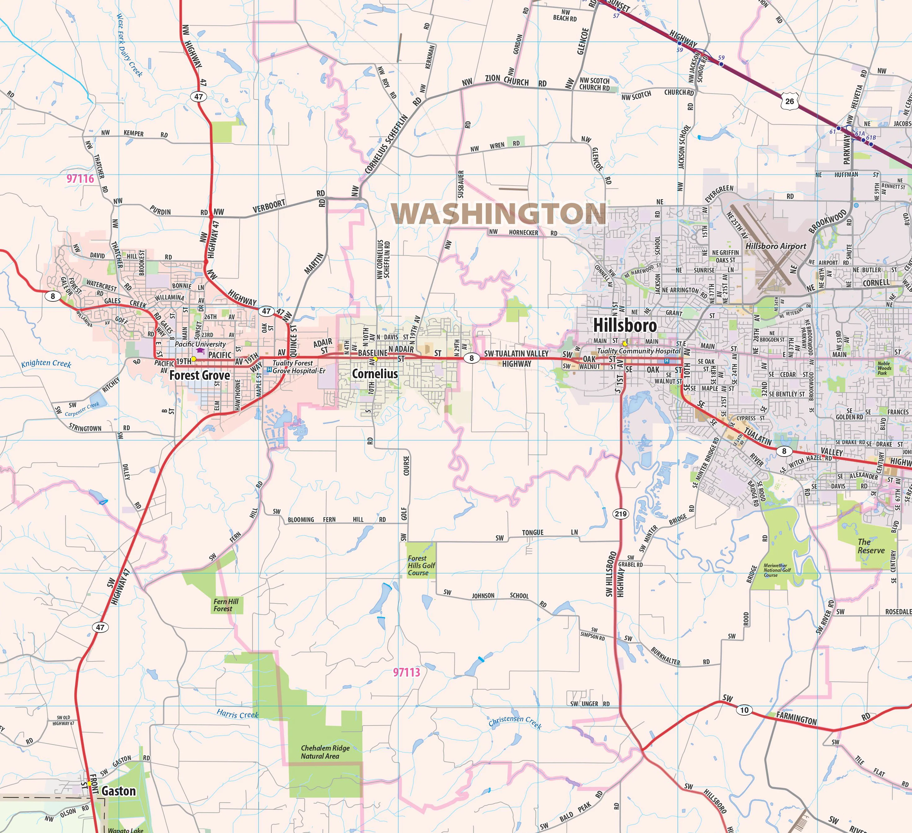
Wall map of the Greater Portland Metro area showing locations within 20 miles of downtown Portland, including parts of Multnomah, Washington, Columbia, Clark, Clackamas, and Yamhill Counties. Communities included are Portland, Vancouver, Gresham, Beaverton, Aloha, Tigard, Hillsboro, Lake Oswego, Oregon City, Newberg, Canby, Saint Helens, and Forest Grove, among many others. Features shown include cities, towns, major roads and highways, zip codes, and major points of interest. An index of community names is included.
This map comes in a variety of sizes and finishing options. It is shipped rolled in a sturdy cardboard tube.
Product Information
Product Information
Shipping & Returns
Shipping & Returns

Greater Portland Metro Area Wall Map
Greater Portland Metro Area Wall Map
Wall map of the Greater Portland Metro area showing locations within 20 miles of downtown Portland, including parts of Multnomah, Washington, Columbia, Clark, Clackamas, and Yamhill Counties. Communities included are Portland, Vancouver, Gresham, Beaverton, Aloha, Tigard, Hillsboro, Lake Oswego, Oregon City, Newberg, Canby, Saint Helens, and Forest Grove, among many others. Features shown include cities, towns, major roads and highways, zip codes, and major points of interest. An index of community names is included.
This map comes in a variety of sizes and finishing options. It is shipped rolled in a sturdy cardboard tube.
Select Size
Select Material
From $27.98
Original: $79.95
-65%Greater Portland Metro Area Wall Map—
$79.95
$27.98Product Information
Product Information
Shipping & Returns
Shipping & Returns
Description
Wall map of the Greater Portland Metro area showing locations within 20 miles of downtown Portland, including parts of Multnomah, Washington, Columbia, Clark, Clackamas, and Yamhill Counties. Communities included are Portland, Vancouver, Gresham, Beaverton, Aloha, Tigard, Hillsboro, Lake Oswego, Oregon City, Newberg, Canby, Saint Helens, and Forest Grove, among many others. Features shown include cities, towns, major roads and highways, zip codes, and major points of interest. An index of community names is included.
This map comes in a variety of sizes and finishing options. It is shipped rolled in a sturdy cardboard tube.

