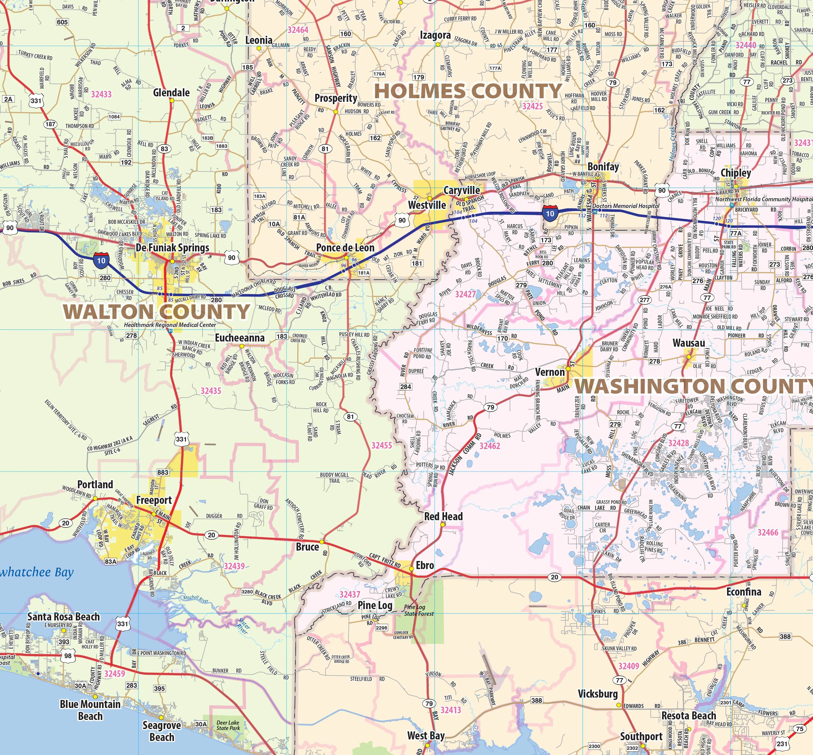
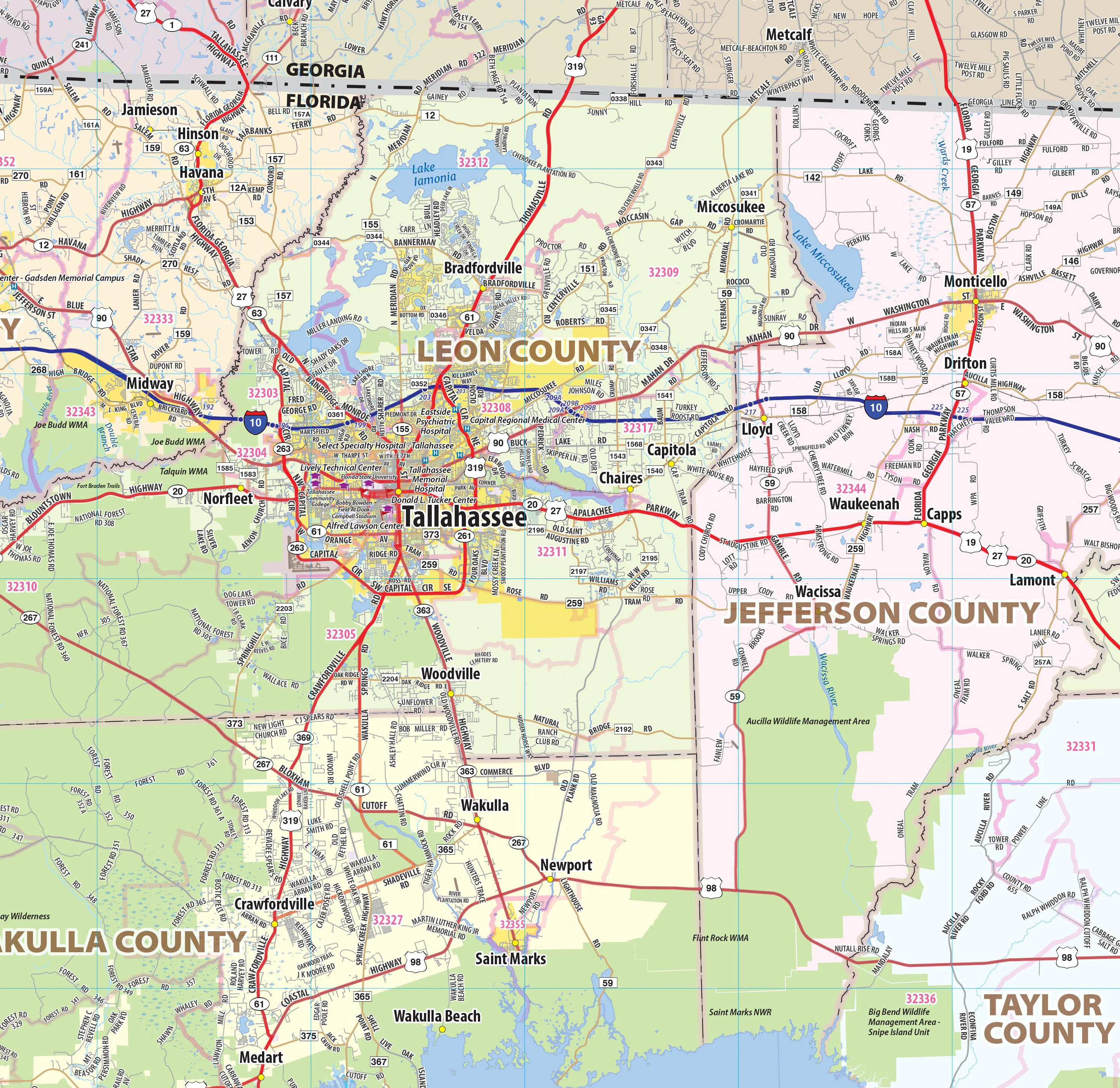
Florida Panhandle Wall Map
Our Florida Panhandle wall map shows the area from the Florida/Alabama border in the west to Tallahassee in the east, including Pensacola, Navarre, Destin, Panama City, Port St. Joe, and Marianna, among others. Interstates, major highways and secondary roads are shown, as well as cities, counties, towns, and major points of interest.
This map comes in a variety of sizes and finishing options. It is shipped rolled in a sturdy cardboard tube.
Product Information
Product Information
Shipping & Returns
Shipping & Returns


Florida Panhandle Wall Map
Florida Panhandle Wall Map
Our Florida Panhandle wall map shows the area from the Florida/Alabama border in the west to Tallahassee in the east, including Pensacola, Navarre, Destin, Panama City, Port St. Joe, and Marianna, among others. Interstates, major highways and secondary roads are shown, as well as cities, counties, towns, and major points of interest.
This map comes in a variety of sizes and finishing options. It is shipped rolled in a sturdy cardboard tube.
Original: $99.95
-65%$99.95
$34.98Product Information
Product Information
Shipping & Returns
Shipping & Returns
Description
Our Florida Panhandle wall map shows the area from the Florida/Alabama border in the west to Tallahassee in the east, including Pensacola, Navarre, Destin, Panama City, Port St. Joe, and Marianna, among others. Interstates, major highways and secondary roads are shown, as well as cities, counties, towns, and major points of interest.
This map comes in a variety of sizes and finishing options. It is shipped rolled in a sturdy cardboard tube.