🚚 Free Worldwide Shipping on All Orders!Shop Now
Boston and Suburbs Wall Map
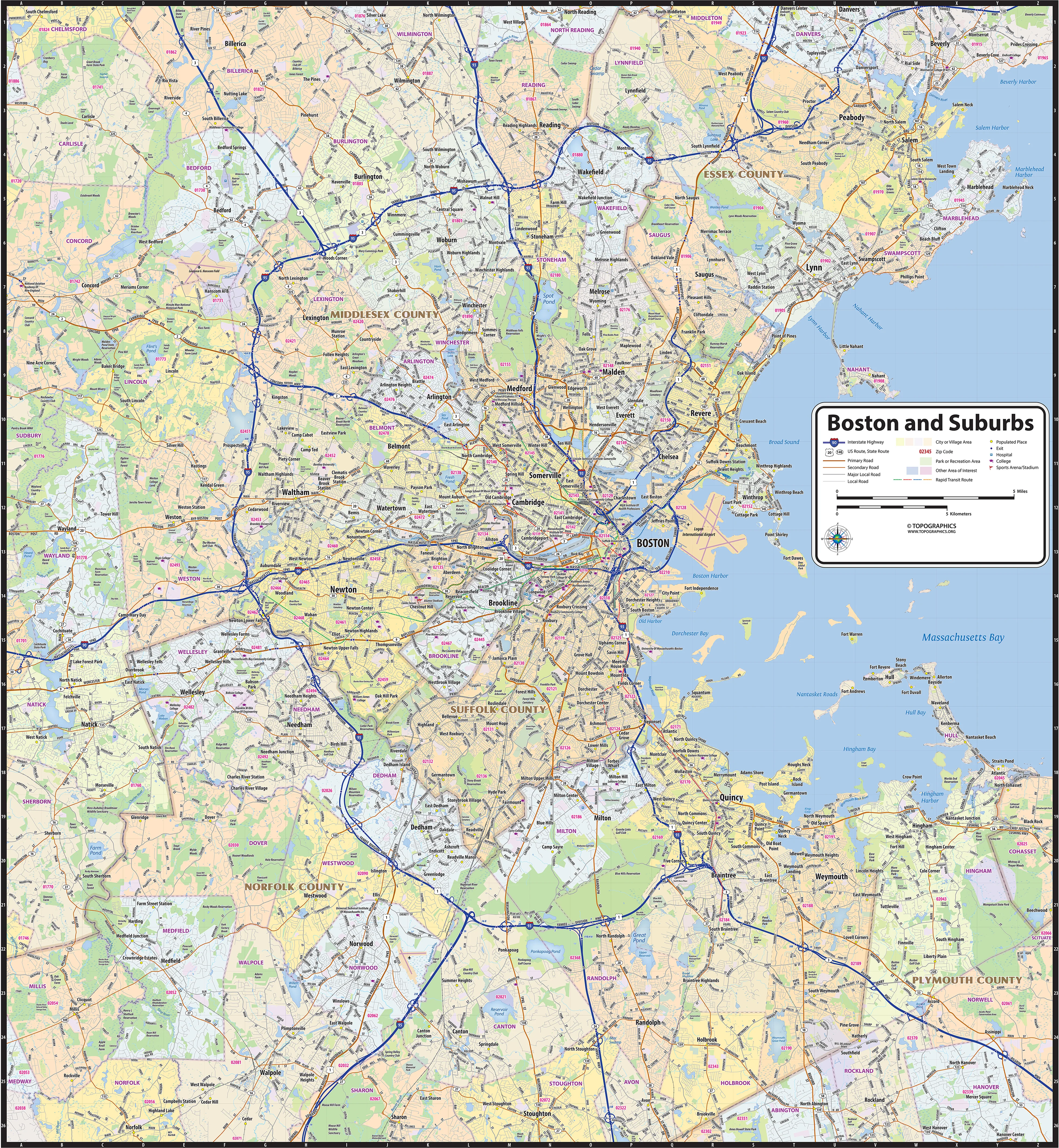
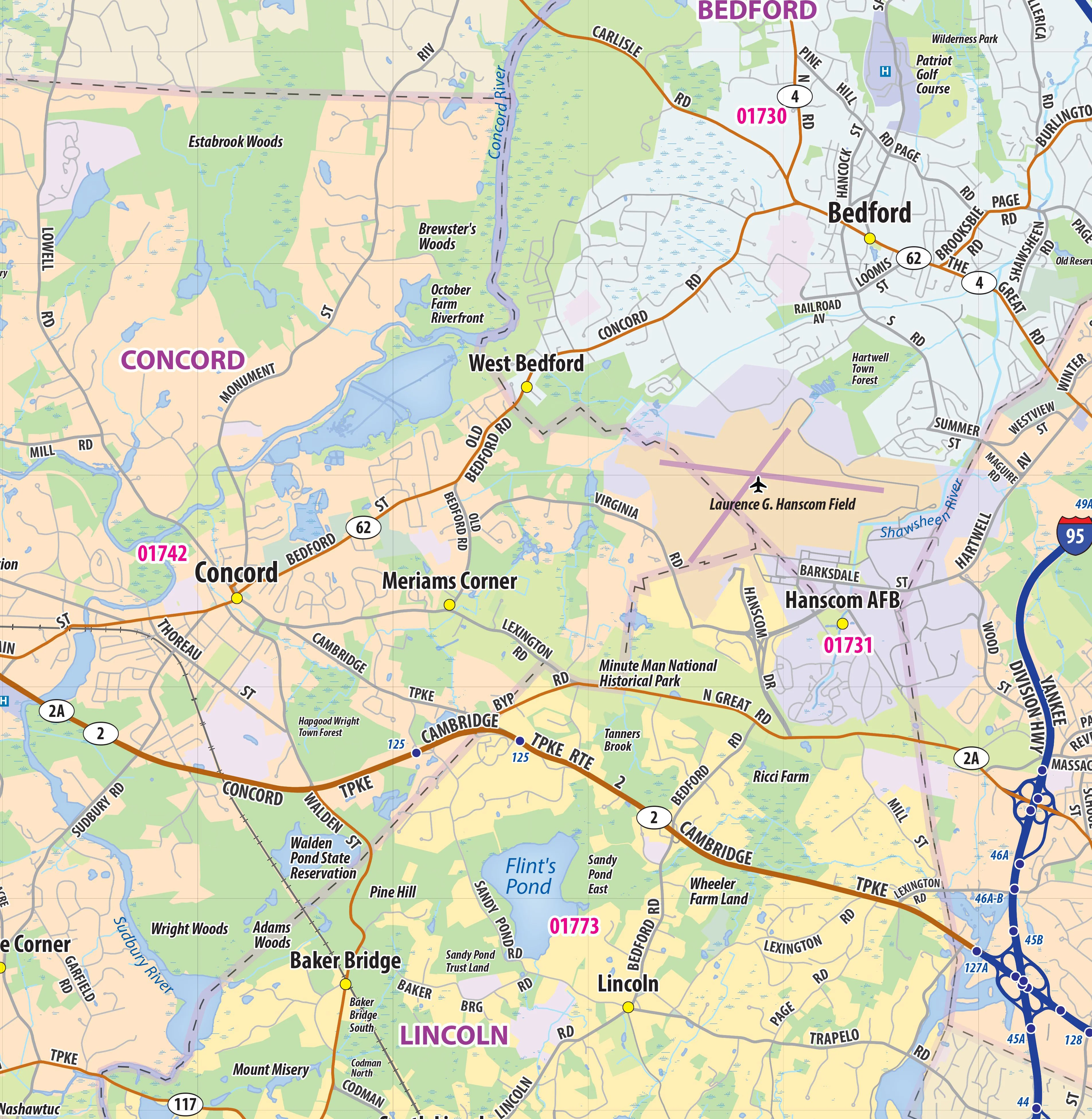
Our Boston and Suburbs wall maps shows the area within 15 miles from downtown Boston, including towns and cities along the I-95 corridor, from Salem in the northeast to Natick in the west, to Randolph in the south. The map shows towns, counties, major highways and routes, as well as major points of interest. Note: due to the vast extent of this map, local street names are not shown.
This map comes in a variety of sizes and finishing options. It is shipped rolled in a sturdy cardboard tube.
Product Information
Product Information
Shipping & Returns
Shipping & Returns


Boston and Suburbs Wall Map
Boston and Suburbs Wall Map
Our Boston and Suburbs wall maps shows the area within 15 miles from downtown Boston, including towns and cities along the I-95 corridor, from Salem in the northeast to Natick in the west, to Randolph in the south. The map shows towns, counties, major highways and routes, as well as major points of interest. Note: due to the vast extent of this map, local street names are not shown.
This map comes in a variety of sizes and finishing options. It is shipped rolled in a sturdy cardboard tube.
Select Size
Select Material
From $27.98
Original: $79.95
-65%Boston and Suburbs Wall Map—
$79.95
$27.98Product Information
Product Information
Shipping & Returns
Shipping & Returns
Description
Our Boston and Suburbs wall maps shows the area within 15 miles from downtown Boston, including towns and cities along the I-95 corridor, from Salem in the northeast to Natick in the west, to Randolph in the south. The map shows towns, counties, major highways and routes, as well as major points of interest. Note: due to the vast extent of this map, local street names are not shown.
This map comes in a variety of sizes and finishing options. It is shipped rolled in a sturdy cardboard tube.